ERETZ YISROEL = ISRAEL ISRAEL ISRAEL!!!!!
I have not been by a computer for a while as you may know, well for those that don't know I went to
The State of Israel Medinat Yisra'el; Arabic: دَوْلَةْ إِسْرَائِيل, Dawlat Isrā'īl) is a country in Western Asia on the eastern edge of the Mediterranean Sea. It is a parliamentary democracy and the world's only Jewish state. In May 2006 its population is estimated at 7,026,000 people.
מדינת ישראל
Medīnat Yisrā'el
دولة إسرائيل
Dawlat Isrā'īl
State of
| |||||
| Motto: none | |||||
| Anthem: Hatikvah | |||||
 | |||||
| Capital | Jerusalem[1] | ||||
| Largest city | Jerusalem | ||||
| Official language(s) | Hebrew, Arabic | ||||
| Government | Parliamentary democracy Moshe Katsav Ehud Olmert | ||||
| Independence Declaration | From the United Kingdom 14 May 1948 (05 Iyar 5708) | ||||
| Area - Total - Water (%) | 20,770 km² (150th) 8,019 sq mi ~2% | ||||
| Population - May 2006 est. - 2003 census - Density | 7,026,000 (97th) 6,780,000 333/km² (19th) 862.5/sq mi | ||||
| GDP (PPP) - Total - Per capita | 2005 estimate $163.45 billion (52nd) $22,944 (32nd) | ||||
| HDI (2003) | 0.915 (23rd) – high | ||||
| Currency | New Israeli sheqel (₪) (ILS) | ||||
| Time zone - Summer (DST) | UTC+2 (UTC) UTC+3 (UTC) | ||||
| Internet TLD | .il | ||||
| Calling code | +972 | ||||


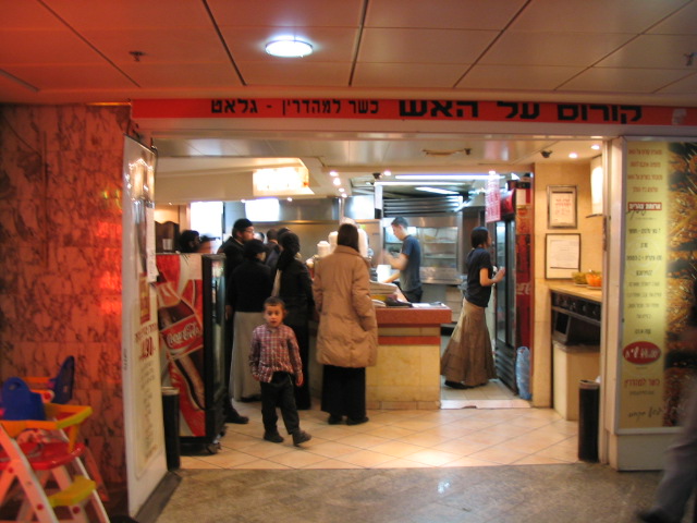
Flight From Warsaw To Israel Sunday March 26 . I arrived in Israel at 1:00 AM. I took a Taxi To Kfar Chabad. I stayed there for one day visited the Matzah Bakery and Zalman's Pizza.
Day 1 - Monday
Kfar Chabad - (No Pictures as of yet.)
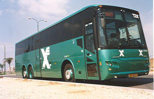
Day 2 - Tuesday Egged to Jerusalem

Day 3 - Wednesday.
View From the porch where I stayed.


Center 1
Lunch with a couple of guys from CRC.

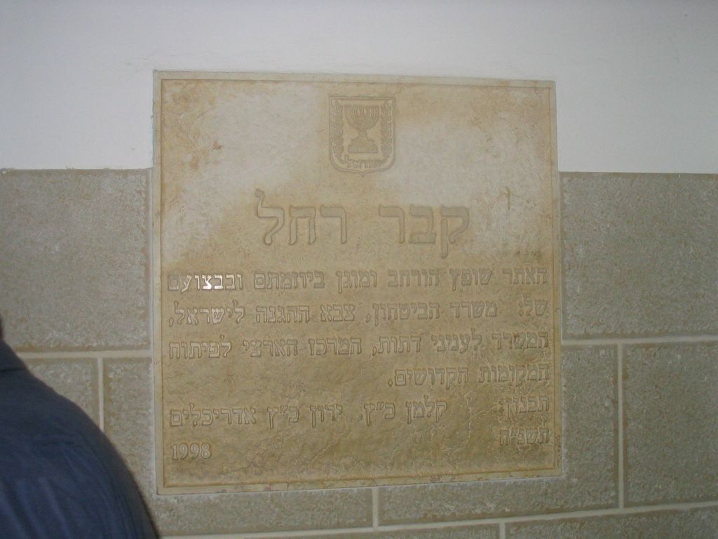
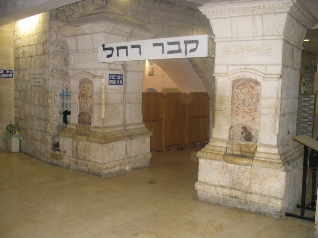
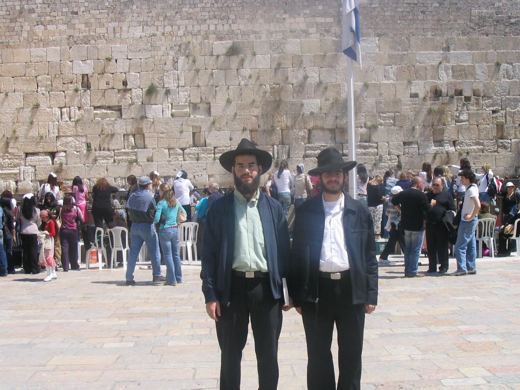
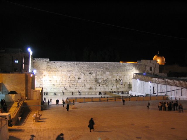
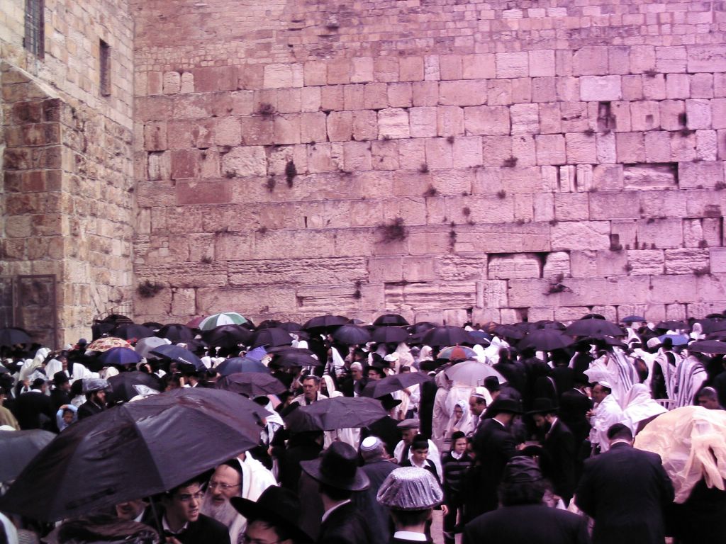
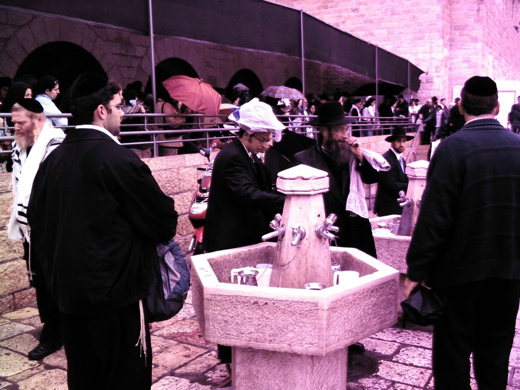
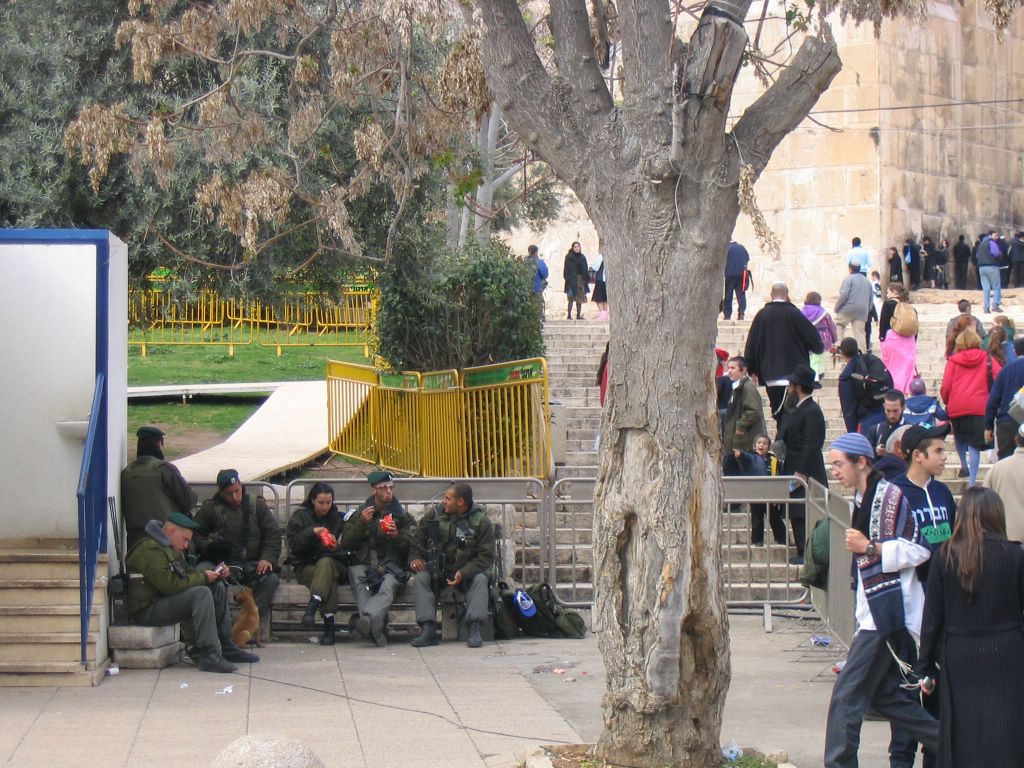
Day 4-Thursday- Kaver Rachel and Kosel-Kotel.


The Western Wall
The Western Wall (Hebrew: הכותל המערבי, translit.: HaKotel HaMa'aravi), or simply The Kotel, is a retaining wall in Jerusalem that dates from the time of the Jewish Second Temple. It is sometimes referred to as the Wailing Wall, or as the al-Buraq Wall, in a mix of English and Arabic. The Temple was the most sacred building in Judaism. Herod the Great built vast retaining walls around Mount Moriah, expanding the small, quasi-natural plateau on which the First and Second Temples stood into the wide open spaces of the Temple Mount seen today.
In recent centuries, Jews were allowed little or no access to the site, such as when Turkey (the Ottoman Empire) ruled over it for 400 years (1515-1917), followed by the British Mandate of Palestine (1917-1948) and the Jordanian rule of Jerusalem (1948-1967). Only when the Israel Defense Forces won a victory in the 1967 Six Day War were Jews finally able to gain free access to the site.


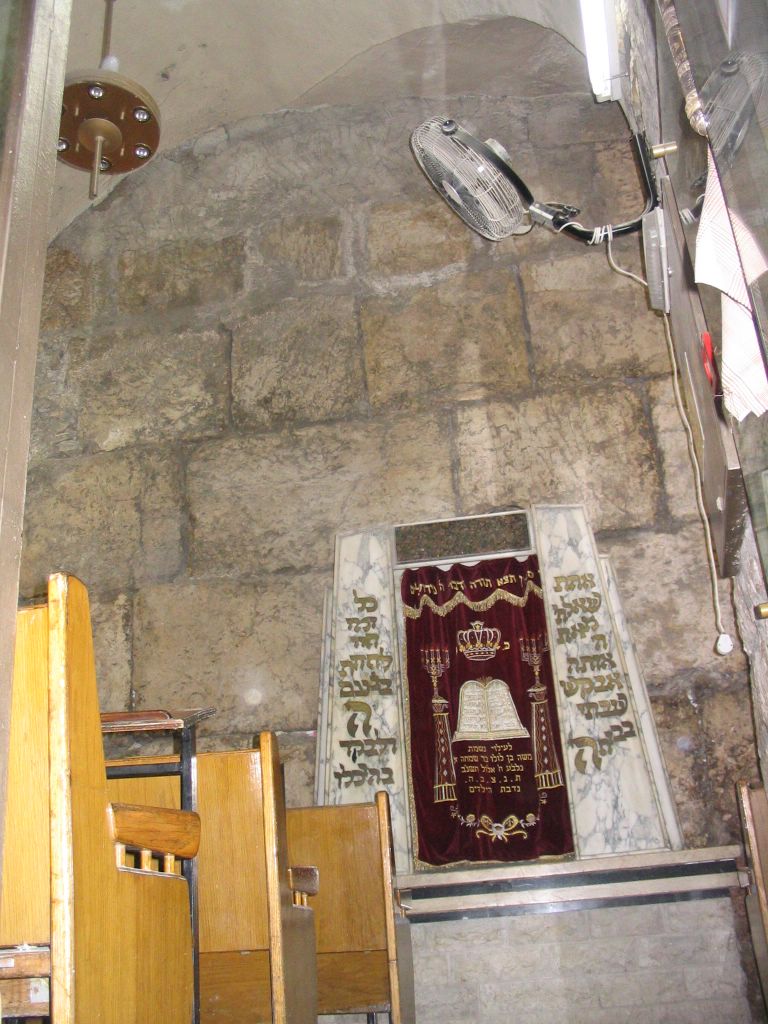
The Shul by the Kosel.


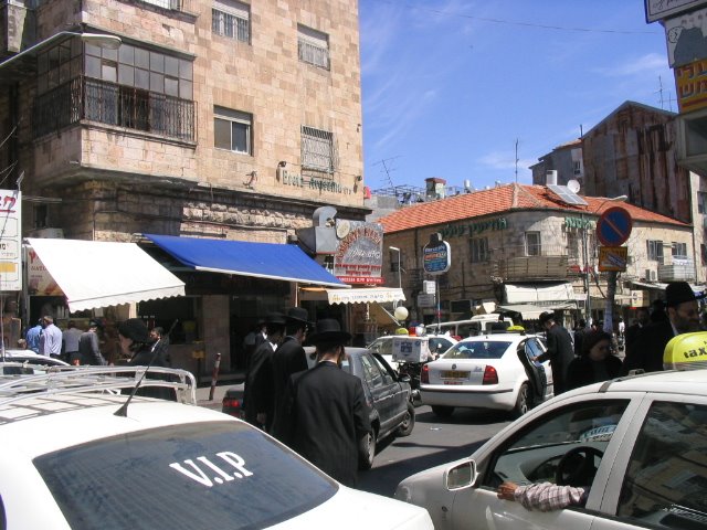
Arab Shuk- Marketplace


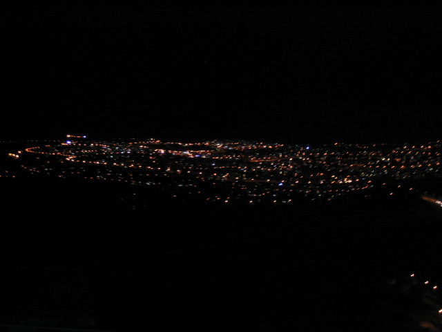
View @ night

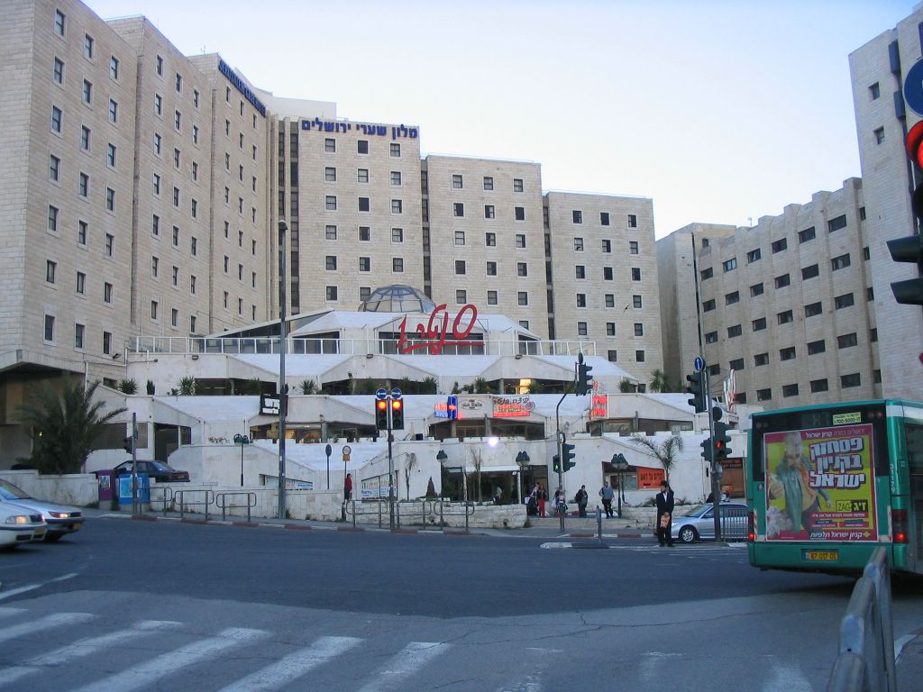
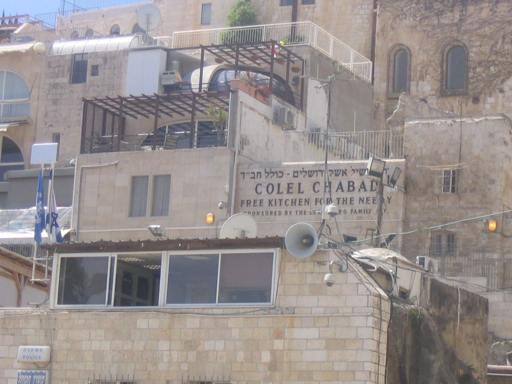
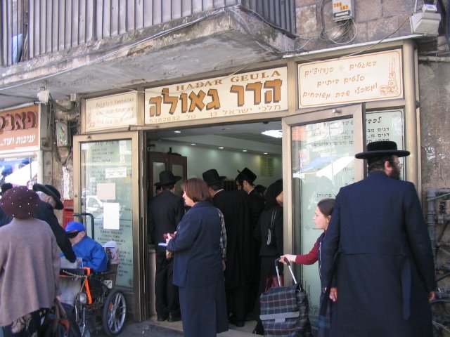
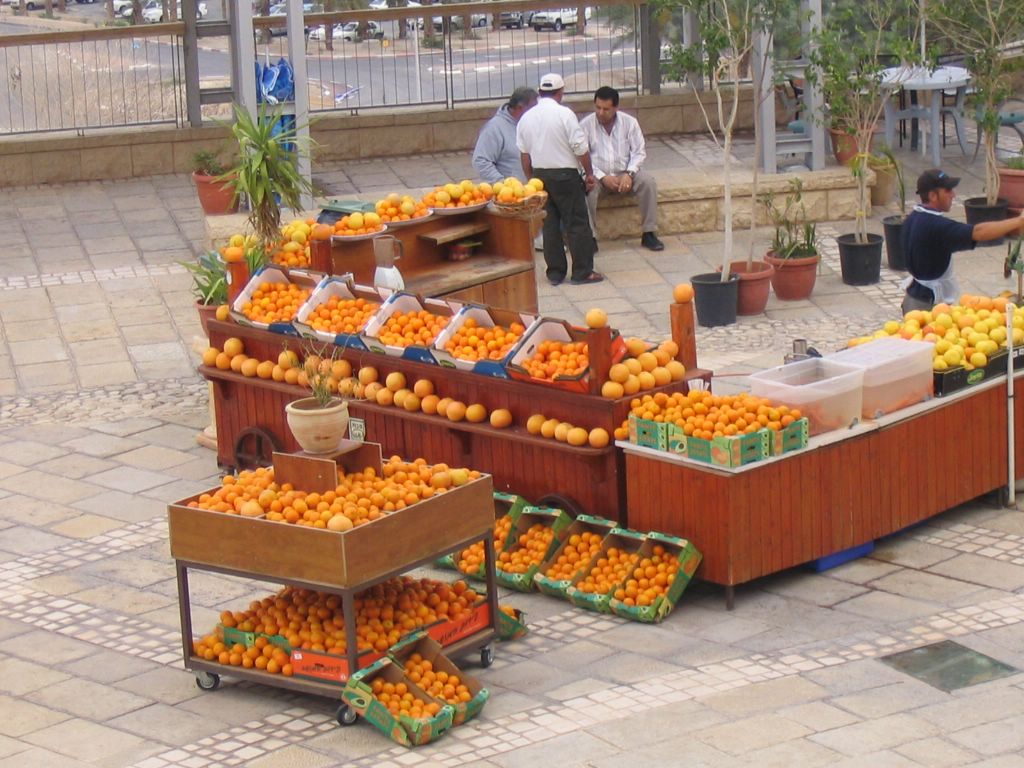
Day 5 - Friday-Geula

Day 6 - Motzohai Shabbos Center one Pizza.

Day 7 - Sunday - Center 1 and cleaning for Pasach.

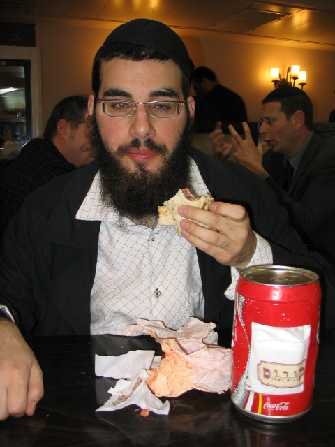
Day 8 - Monday-Ben Yehudah - Sbarro

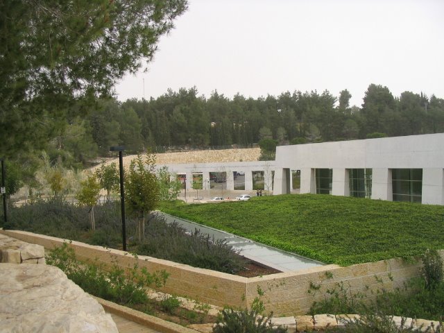
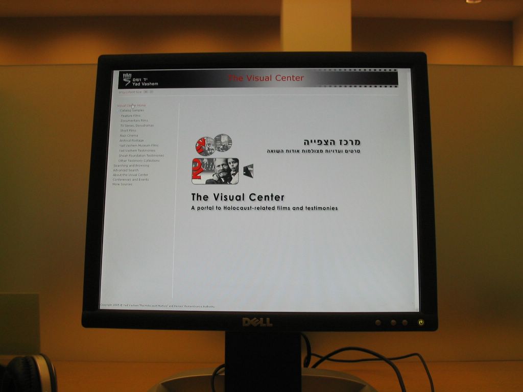
Day 9 - Tuesday Yad VaShem - Time Elevator - Kosel Tunnels.


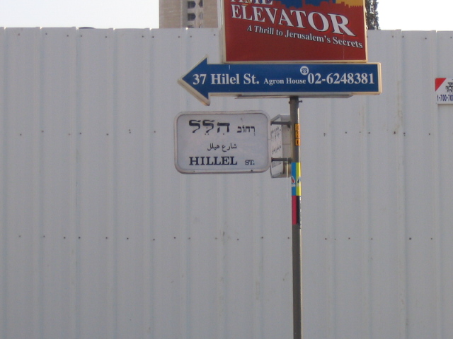
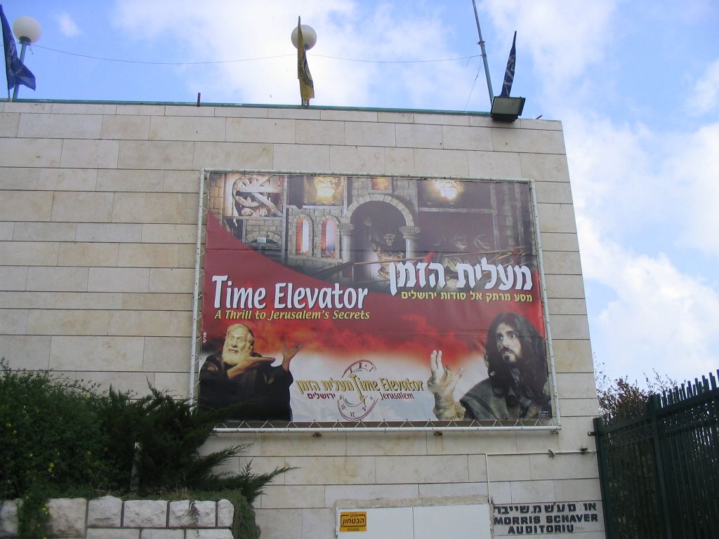

What Is Time Elevator?
Know
3,000 years of history are presented in a fascinating interactive way to provide you with a unique and unforgettable experience.
Audiences will witness Prophet Jeremiah’s confrontation with King Zedekiah and relive the destruction of the First and
The Time Elevator Jerusalem is a journey through the rich 3,000 years of the cities history. Star of “Fiddler on the Roof,” Chaim Topol plays the lead character who amid crashing ceilings, splashing water, and other special effects, leads us on an unforgettable journey moving through Jerusalem’s historic turning points; beginning with the City of David and ending in the 1967 Six-Day War.
The Time Elevator is becoming an essential part of any tour of
Multi Sensory Experience
Combining film, motion platforms, and special effects, this journey brings
Combining motion based seating, panoramic screens, special effects carefully synchronized to the action of the film, visitors have the sensation of viewing the movie as a participant rather than a spectator. Surround sound headsets enable the show to be concurrently heard in English, Russian, French, Spanish, German and Hebrew.
This unique and unforgettable experience combines learning and enjoyment in the best tradition of "Edutainment".
•The Time Elevator is an attraction for the whole family (for visitors over the age of 5)
•Visitors must arrive 10 minutes prior to show time to watch an introductory film reviewing safety instructions
Seat System
Our motion based seat system lets the viewer to feel completely "swallowed-up" inside the history of Jerusalem and to feel a complete part of the Jerusalem experience – soaring over the city, moving through the many underground tunnels, bursting into the besieged city with Titus' fearsome army, or narrowly escaping Zedekiah's cave like the king himself. Our revolutionary and innovative system of motion based seats is the first of its kind in
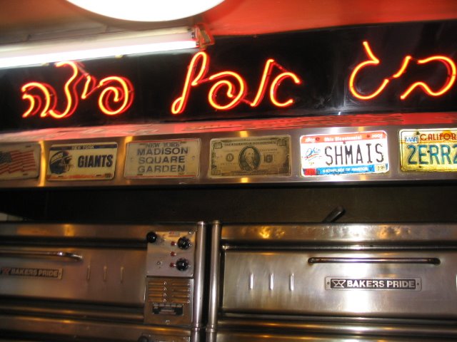
SHMAIS license Plate
Kosel @ Night.
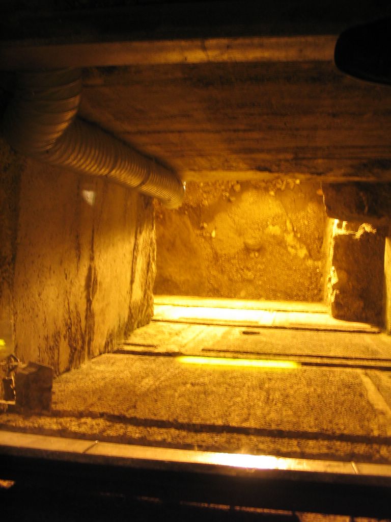
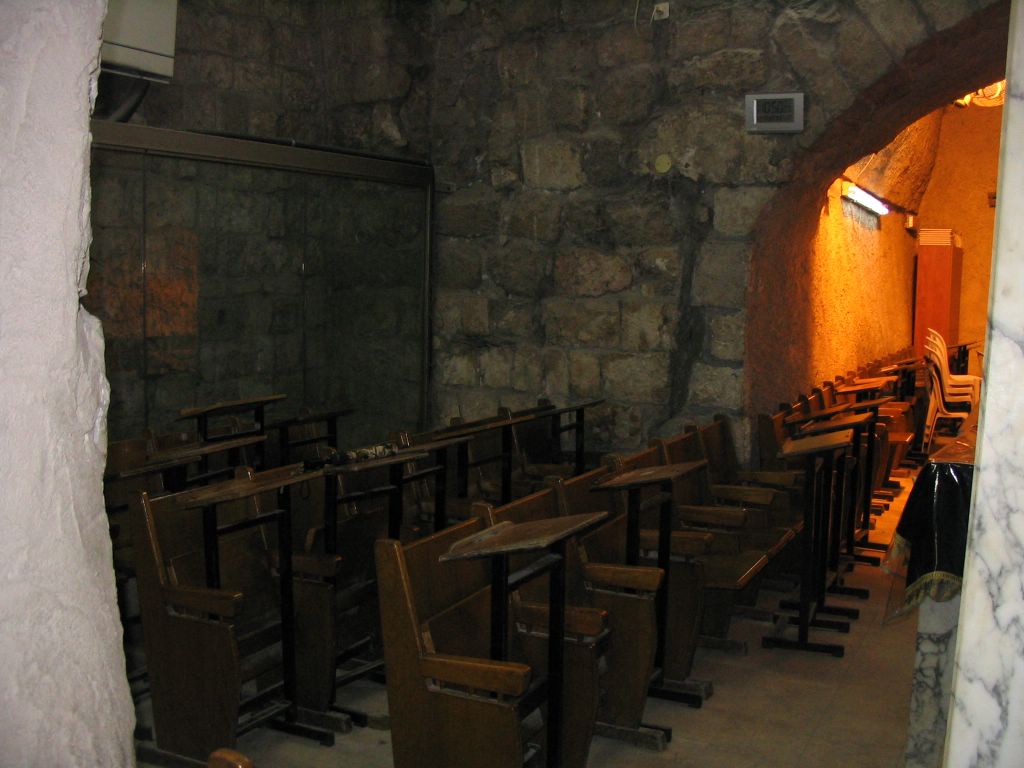
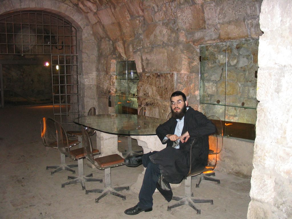
Kosel Tunnels.

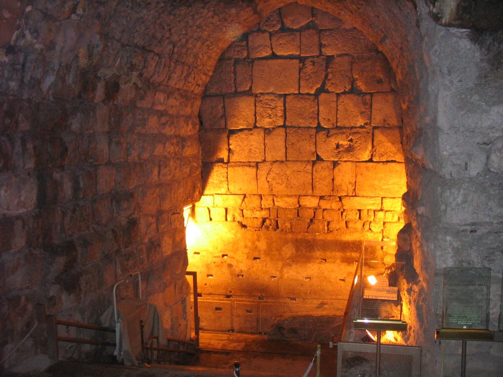

Directly across where The Kodesh HaKodoshim was the closest point you can get too.


The Shul inside the Kosel Tunnels.
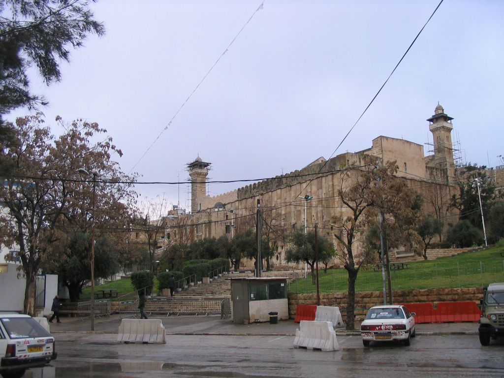
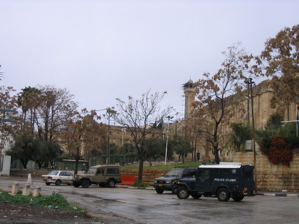
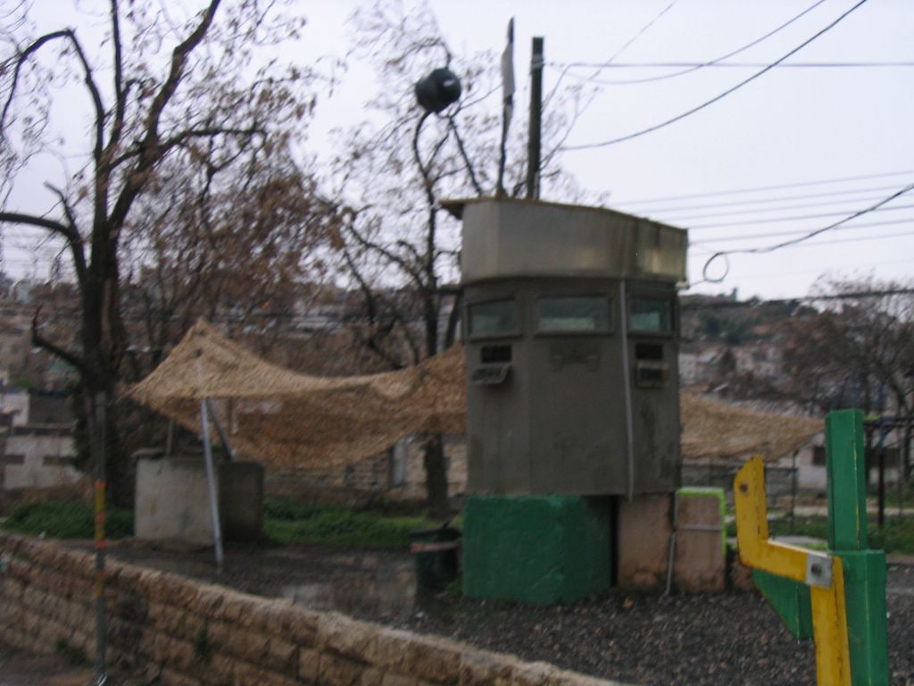
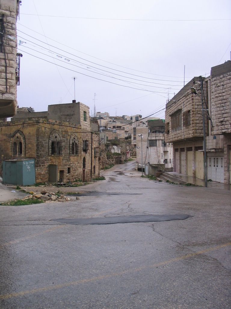
Day 10 - Wednesday-Migdal Dovid-Dovid-Chevron-Meoras Hamachpelah.
Tower of David
The Tower of David is Jerusalem's "citadel", a historical and archaeological site of world importance.
This is a medieval fortress, with later additions. Its towers and ramparts offer splendid views of that part of Jerusalem where Old and New meet, and East meets West. The site of the citadel has always been the weak point in the city's defenses, compelling its rulers throughout history to fortify the site.
This important historical and archeological site was built in the First Temple Period (960-586 BCE). Parts of a tower and the city wall were built by the Hasmonean (first century BCE). The base of the tower was built by Herod the Great (37-34 BCE).


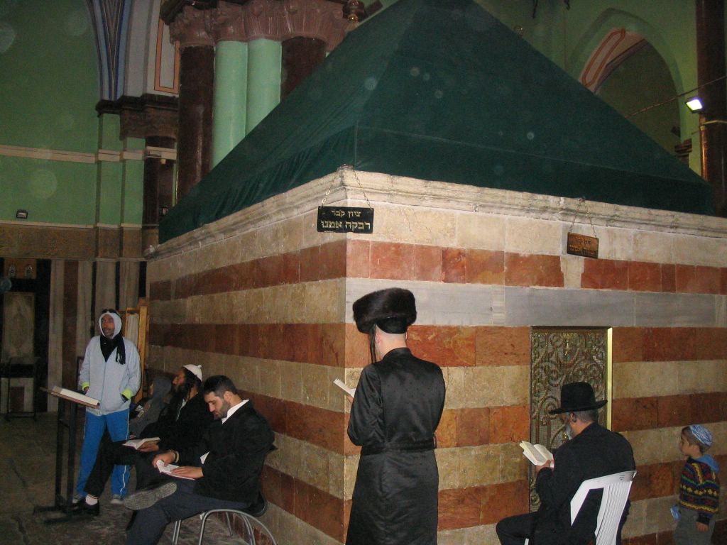
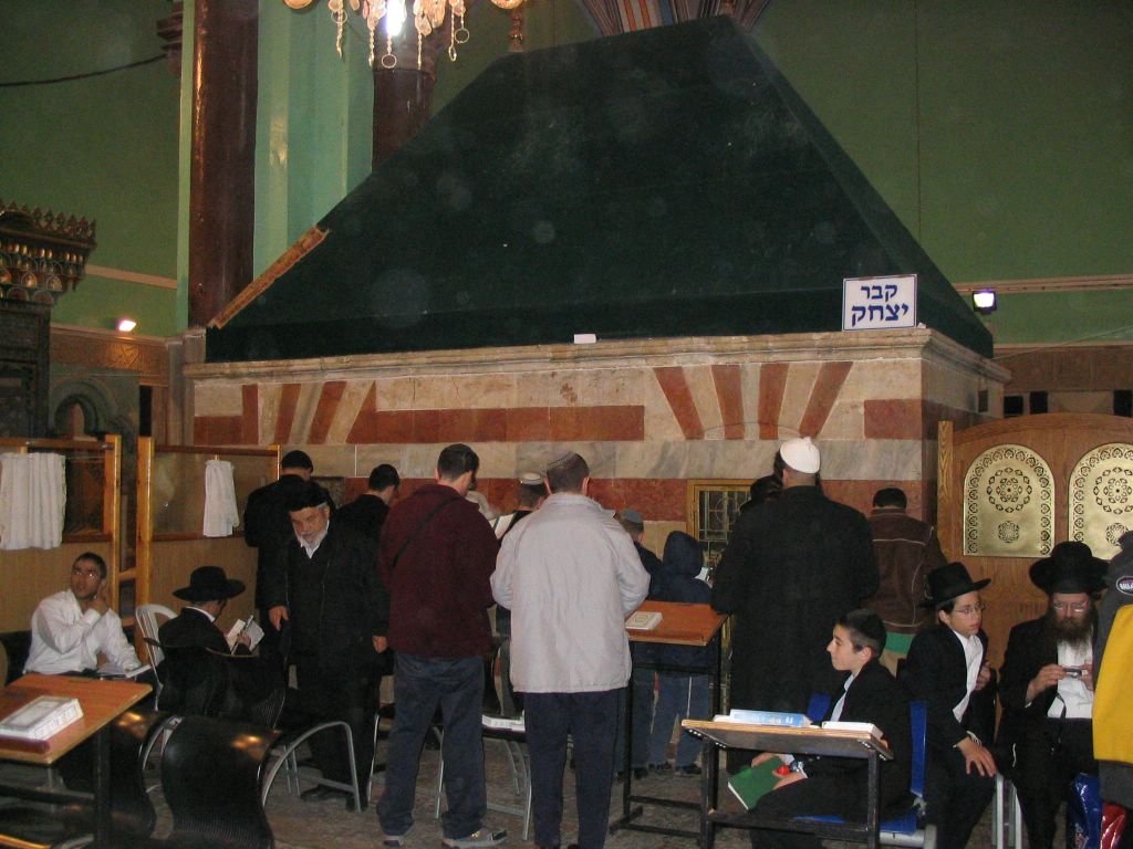
This is where Dovid HaMelach (King David) is buried.

Some people hold this is where Dovid is buried.

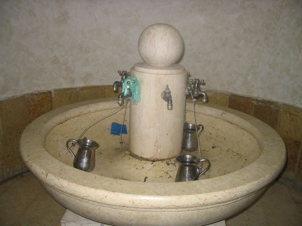
Washing your hands, the guy is pulling water out of a well.

Chevron one of the four Holy Cities of Israel.
The primary holy city in Judaism is Jerusalem—the ancient capital of the united Kingdom of Israel and then of the Kingdom of Judah. It is the current capital of the State of Israel. Mentioned repeatedly in the Torah and the site of the Temples in Jerusalem: the First Temple (Solomon's Temple) and the Second Temple. There are also three other holy cities of somewhat lesser importance to the Jewish people. These cities have played important roles in Jewish history, and were (along with Jerusalem) the main centers of Jewish population in Palestine between the Roman conquest of Jerusalem and the 19th century:
- Hebron—the second-holiest site and the place where the Tomb of the Patriarchs and Matriarchs is located. According to Jewish tradition this is the burial place of the great patriarchs (Abraham, Isaac, and Jacob) and matriarchs (Sarah, Rebeccah, and Leah). The capital of the Kingdom of Israel before David moved it to Jerusalem.
- Tzfat, where much of the Jerusalem Talmud was written and kabbalah (Jewish mysticism) was developed by Isaac Luria.
- Tiberias was the last meeting place of the Sanhedrin and the site of a number of important tombs.
While not considered holy cities per se, the following cities had great spiritual significance to Jews through the ages because of their close association with the development of Jewish law and culture:
- Be'er Sheva, settlement attributed to the patriarch Abraham.
- Bethlehem, burial place of the matriarch Rachel and birthplace of King David.
- In ancient times, alternative temples to the one in Jerusalem were established at Elephantine and Leontopolis.
- Yavne and Sepphoris, sites of the Sanhedrin following the destruction of the Second Temple.
- Sura and Pumbedita (and earlier Mahuza and Nehardea), sites of the Talmudic acadamies in Babylonia.
- Lublin, site of the Council of Four Lands and center for Ashkenazi religious and political life for much of the 16th, 17th, and 18th centuries CE. Vilna and Munkacs were also major centers of Jewish learning, and were often referred to as the "Jerusalems" of Europe.
- Thessaloniki (Salonika), center of Sephardi learning under the Ottoman Empire and refuge for Jews fleeing from Spain.
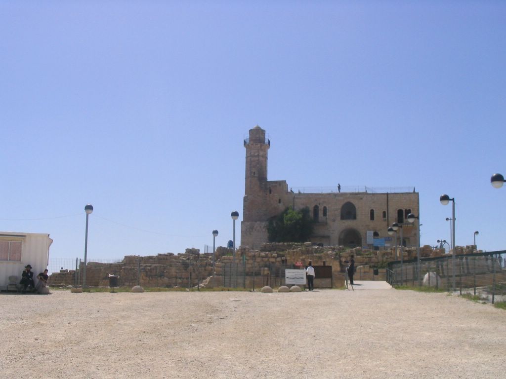
Me'arat Ha-machpela
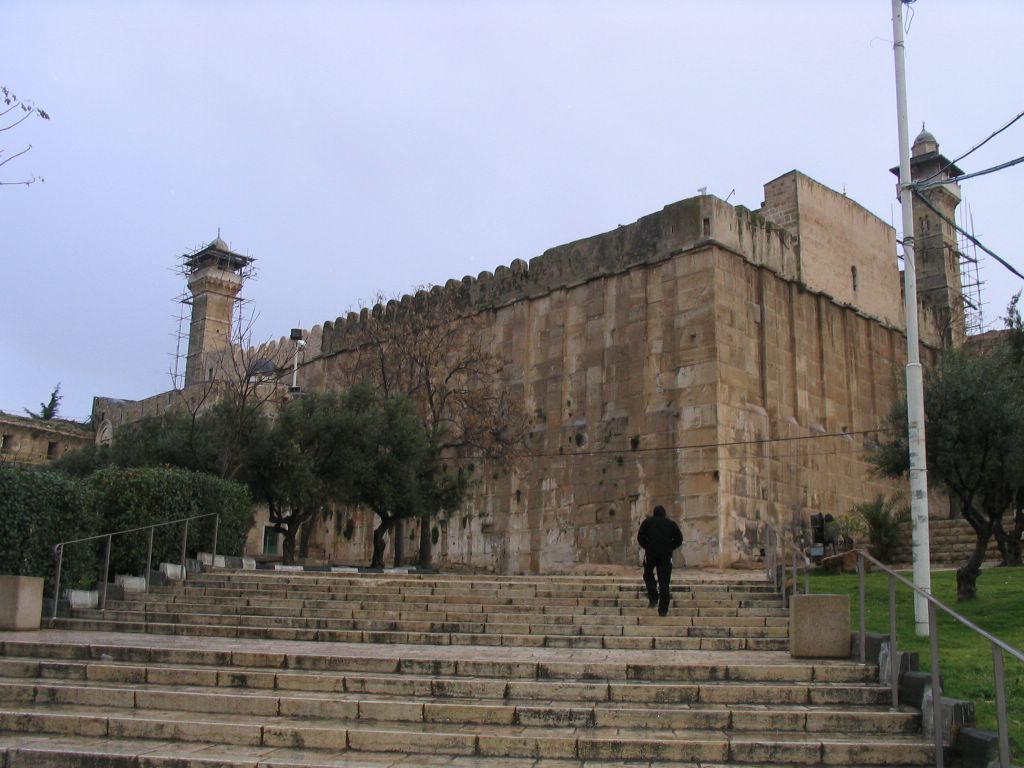


They say here is where Adam and Chava are buried.


The kollel Shul in the me'arat ha-machpela.

Mincah


Supper
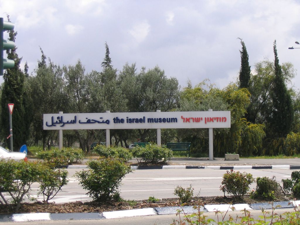
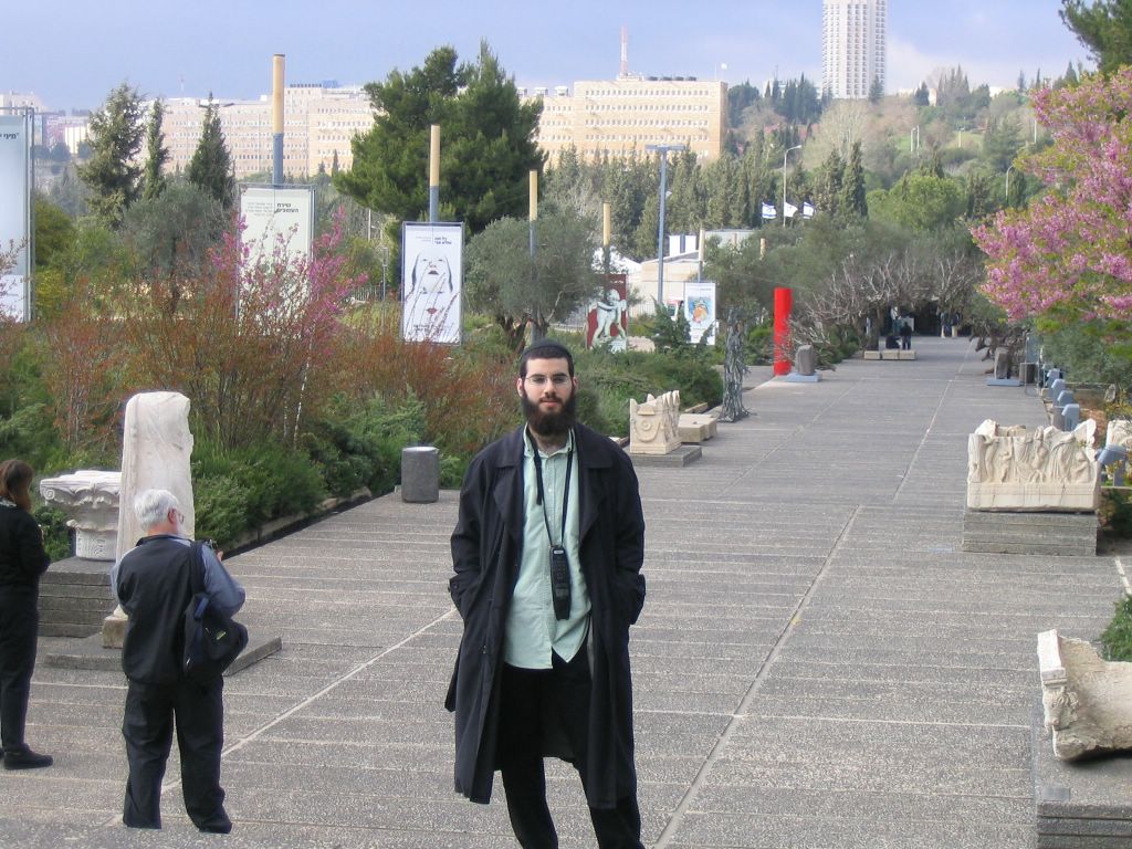
Day 11-Thursday-Museum of Israel and the Knesset.


Day 12-Friday-Geulah Meah Shearim
Day 13-Shabbos
Day 14
(No pics sorry)
Hermon


Mount Hermon (Arabic: جبل الشيخ Jabal El-Sheikh, Djabl A-Sheikh Hebrew: חרמון) is a mountain in the Anti-Lebanon range, on the border between Lebanon and Syria. At
Location and setting
The mountain is actually a cluster of mountains with three distinct summits, each about the same height. The Anti-Lebanon range extends for approximately 150 kilometres (93 miles) in a northeast to southwest direction, running parallel to the
The mountain forms one of the greatest geographic resources of the area. Because of its height it captures a great deal of precipitation in a very dry area of the world. The Jurassic age limestones are broken by faults and solution channels to form a karst topography.
Meltwater from the snow-covered mountain’s western and southern bases seeps into the rock channels and pores, feeding springs at the base of the mountain, which form streams and rivers. These merge to become the Jordan River. Additionally, the runoff facilitates fertile plant life below the snow line, where vineyards and pine, oak, and poplar trees are abundant.
The springs, and the mountain itself, are much contested by the nations of the area for the use of the water. It is important who controls the mountain, as well as the springs below, to guard against deforestation and pollution.
Historical and Biblical significance
The high places of
Mount Hermon was a possible site of the Transfiguration, where Jesus took three of his disciples, Peter, James, and John, up on a high mountain for prayer. Before their eyes, Jesus was transfigured. He became radiantly white and conversed with Moses and Elijah, who had appeared beside him. The disciples’ amazement and fear were further increased, when a voice from heaven exclaimed, "This is my beloved Son, with whom I am well pleased; listen to him!" (Matt 17:1-8; Mark 9:2-8; Luke 9:29-36).
In the Book of Enoch,
Therefore, in religion and legend,
Day 15 -Tzfas-Arizal's Mikvah Amukah-Yochanan Ben Uziel- Miron-Rabbi Shimon Bar Yochai-Teveriah-Rab Mayer Bal Hanes, Shimon Ben Elazer, Sumchus Rabbi Akivah.(No Pictures)
Yonathan ben Uzziel (Hebrew: יונתן בן עוזיאל) [Alternatively Yonatan ben Uziel or Yonosson ben Uziel] is known as the author of Targum Jonathan he is also said to have written a book of Kabbalah known as Megadnim. He was one of the 80 Tannaim who studied under Hillel. His tomb is in Amukah in the Galillee near Tzfat, Israel. Traditionally those who are unmarried visit this location in order to be granted blessings in his honor and in his merit find a marriage partner. The Talmud in Sukkah 28a tells that while he was absorbed in studying Torah if a bird flew over his head it would be burnt (possibly a metaphor meant to say that any scholar who wished to differ in opinion with him was incapable of such).
Yonathan ben Uzziel

New York Times:
Published:June 22, 2004
AMUKA, Israel, June 15 — In these days of matchmaker.com and television's "Bachelorette," there are thousands of men and women in this country who look for love in a decidedly old-fashioned way: they pray at the tomb of a rabbi who has been dead for 2,000 years.
The rabbi, Yonatan ben Uziel, was a disciple of Hillel, the revered Talmudic sage of the first century B.C. Rabbi Yonatan was said to study Torah with such burning passion that any bird flying overhead would instantly be incinerated.
Like too many people fanatical about their work, he died a bachelor, or so the folk legend has it. Yet there has evolved around him an unshakable belief that he can intercede for those desperate to find love.
That is why every year, on the yahrzeit or anniversary of his death in the Hebrew calendar, thousands of pilgrims in buses and cars — young Hasidic men with peach-fuzz cheeks, women in tight jeans and aviator glasses, grizzled parents frantic to find a spouse for sons and daughters who have reached the ripe age of 25 — descend on this gorge of cedars and olive trees in the northern Galilee to recite Psalms at Rabbi Yonatan's grave.
There was certainly a carnival atmosphere this year, the whiff of a Lourdes for romance rather than healing. Along the sun-baked walk twisting up to the stone-block structure housing the tomb there were vendors, some with prayer fringes, hawking amulets, candles, CD's and kiddush cups. There were panhandlers with a variety of hard-luck stories. There was klezmer music over a loudspeaker, and barbecued food.
Inside the shrine were men and women, crowded into compartments on opposite sides of the tomb, holding battered books of Psalms and swaying and murmuring with fervor, many pressing their fingers tightly against the faded blue velvet covering Rabbi Yonatan's resting place. On the men's side blasts of the shofar cut the air; on the women's side ululations of grief could be heard.
But there was also the plain longing of people who had never found love or had erred in love and hoped still to find it, and of parents who were suffering because their children were alone.
Orly Hazan, a 30-year-old woman from Hadera in denim jacket and pants and a T-shirt that read "Best Brand of the Year," joined a procession of women in wigs and long skirts circling the tomb seven times, a ritual reminiscent of the prayers for salvation during the autumn Sukkot festival.
She said that although she often dated, she prayed at the grave five years ago, asking simply for marriage, and was rewarded with a husband. They were divorced after a year, though, and now she is back to offer a subtly different prayer.
"Now I'll ask to get married to the right one," she said.
Esther Mirav of Ashdod, whose daughter is divorced, emerged from the tomb with tears glistening in her eyes.
"I pray to God that he will send her someone who will love her," she said.
Yoram Bilu, a professor of anthropology and psychology at Hebrew University, said there was a growing veneration of saints in Judaism, paralleling that in Christianity and Islam, as demonstrated by the growing populist reverence for the Talmudic sages whose putative graves are sprinkled throughout Galilee.
He said forces like the turmoil set off by the Palestinian uprising and disillusionment with once popular movements like socialism had led many ordinary Israelis to latch on to a folk mysticism and New Age spirituality.
There were, of course, stories of the miraculous power of Rabbi Yonatan. Sarah Malachi, 63, a Yemenite Jew who has five children and 18 grandchildren, said two of her sons had found mates within a month of praying at the tomb.
"One of the sons came here with a female taxi driver, and he married her," she said.
On the walls of the tomb, some not-so-young cavaliers and maidens had posted messages in the terse style common to the dating columns of New York magazine. One man who described himself as "a 28-year-old son of Torah" said he was "interested in meeting a sensitive, good-hearted girl only for a serious purpose and only one under 26 years old."
"Recommendations by rabbis and friends," the message added.
One of the pilgrims, Yaakov Prince, 20, a black-hatted yeshiva student from Jerusalem, pointed out that the Jewish belief in a divine or charmed intercession in marriage dated back to Abraham, who sent his servant Eliezer to find a match for Isaac.
Stopping at a well, Eliezer knew that the right woman for Isaac would offer water not just to him but to his camels as well. "From that we see that you don't just date, but you have to find the right person," Mr. Prince said.
Approaching the men's entrance to the tomb, Eliyahu Chaim Kitov, a onetime lawyer originally from South Africa, said he was nearly 40 and because of financial and health troubles had never married.
"Some people have to go through troubles and get married late in life," he said, "and I'm one of them."
Samuel and Hadassah Zenwirte of Tiberias, an elderly couple, said they had an unmarried daughter, Inbal, who was preoccupied with the study of law. They decided to travel to Amuka on her behalf to beseech Rabbi Yonatan. The daughter, they said, refused all other remedies they might provide.
"This is the problem," lamented Mrs. Zenwirte. "She wants by herself to find somebody."
Shimon bar Yohai

Rabbi Simeon bar Yohai, (Hebrew: שמעון בר יוחאי, Shimon son of Yohai, Simon son of Yohai), was a famous rabbi who lived in the era of the Tannaim (scholars of the Mishnah) in the area of what is today Israel during the Roman period, after the destruction of the Second Temple. According to the Talmud, he criticized the Roman government and was forced to go into hiding with his son for many years.
He is traditionally attributed with the authorship of the Zohar, the chief work of the Kabbalah and Jewish mysticism according to Orthodox Judaism.
He was one of the most eminent disciples of Rabbi Akiva. His master was executed by Hadrian, and Simeon's anti-Roman sentiments led to his own condemnation by Varna c. 161 CE (according to Graetz). He escaped this doom and dwelt for some years in a cavern. Emerging from concealment, Simon settled in Tiberias and in other Galilean cities.
He acquired a reputation as a worker of miracles, and on this ground was sent to Rome as an envoy, where (legend tells) he exorcised from the emperor's daughter a demon who had obligingly entered the lady to enable Simeon to effect his miracle.
This rabbi bore a large part in the fixation of law, and his decisions are frequently quoted. To him were attributed the important legal homilies called Sifre and Mekhilta, and above all the Zohar, the main work of the Kabbalah. The fullest account of Simeon's teachings is to be found in W Bacher's Agada der Tannaiten, ii. pp. 70-149.

It is widely believe that Rabbi Simeon bar Yochai died on Lag Ba'omer. There is custom to celebrate on the "Yahrzeit," the anniversary of the death, at Meron, the burial place of Rabbi Simeon bar Yochai and his son, Rabbi Elazar bar Simeon. With torches, song and feasting, the Yahrzeit is celebrated, which may seem somewhat odd, but which was a specific request by Rabbi Simeon bar Yochai of his students. It is a custom at the Meron celebrations, dating from the time of Rabbi Isaac Luria, that three-year-old boys are given their first haircuts, while their parents distribute wine and sweets.
Rabbi Simeon, is commonly refered to with the acronym of his name - Rashbi (Hebrew: רשב"י, pronounced - Rash-bee): Rabbi Shimeon bar Yochai.
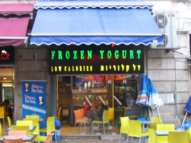
Day 16-Tuesday-Ben Yehuda-Frozen Yogurt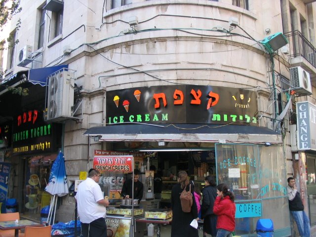
Searching for Chometz
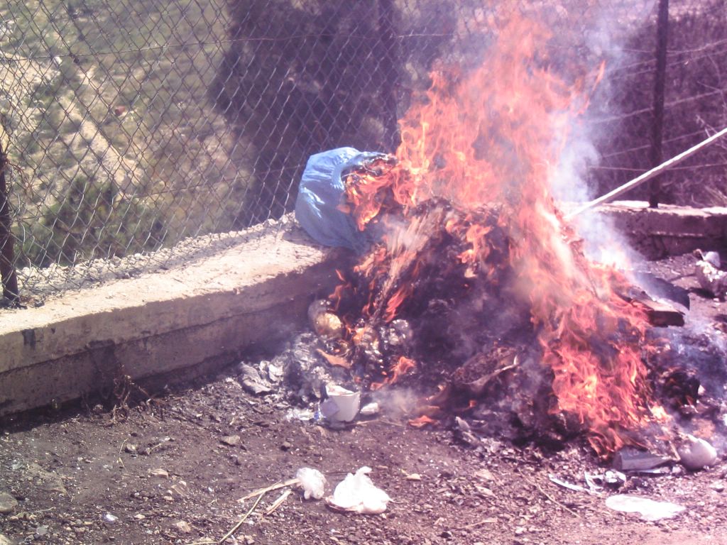
Day 17 Wednesday Erev Yom Tov -Burning Chometz 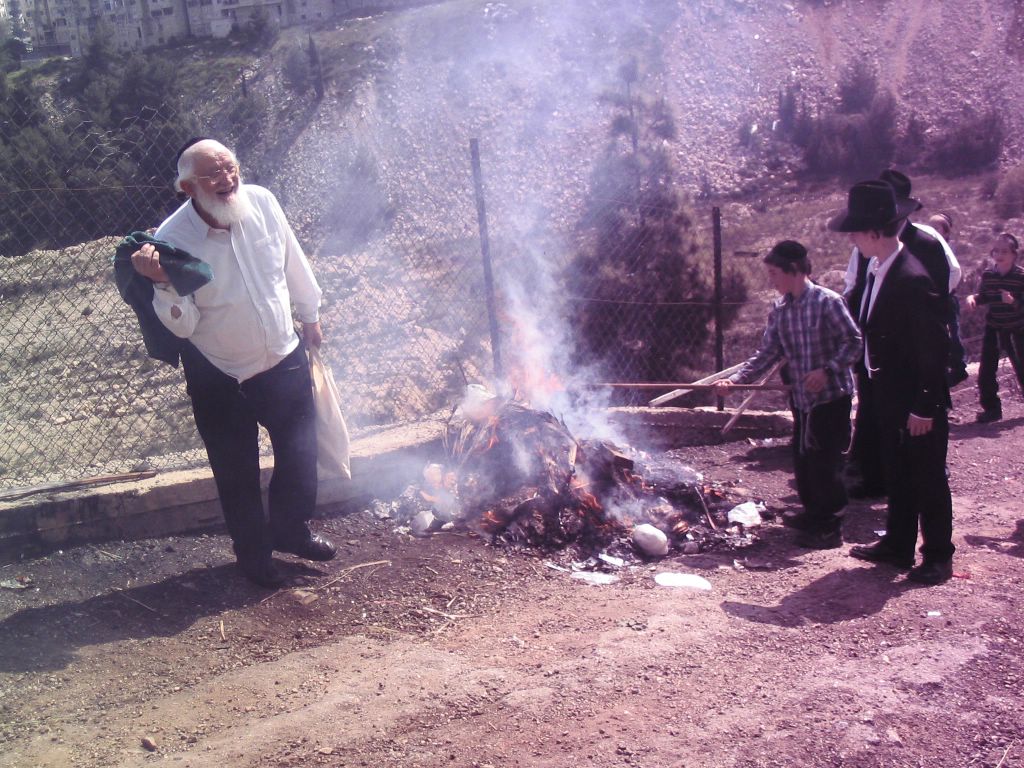
Day 18 -Thursday-Yom Tov
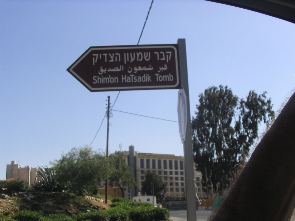
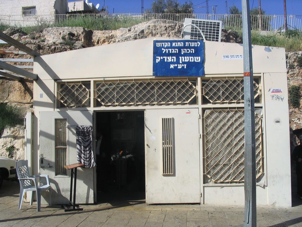
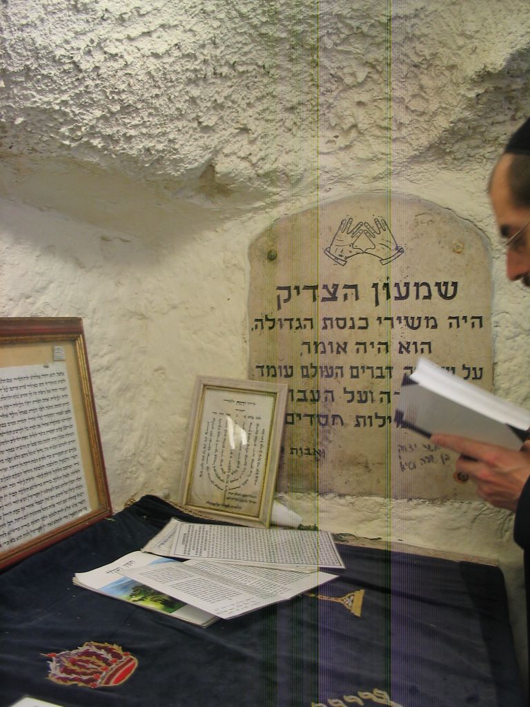
Day 19 - Friday - Shmuel HaNavi and Shimon HaTzadik


Day 20 - Shabbos.
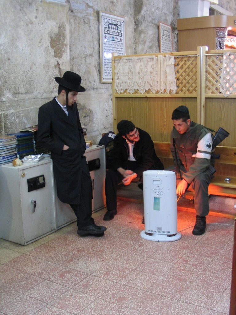
Day 21 - Sunday-Birchas Kohanim-Priestly Blessing-Chevron.
Every Chol Hamod they have a Grand Brichas Kohanim when all the Kohanim come to the Kosel and give the blessing at once.
Chevron-During Chol Hamod the whole Meoras Hamachpelah is open ONLY to the Jews.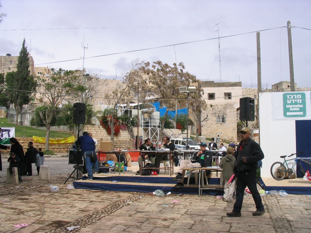

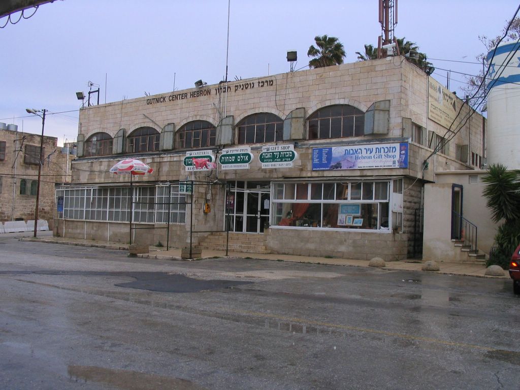
The restaurant in the Gutnick center.

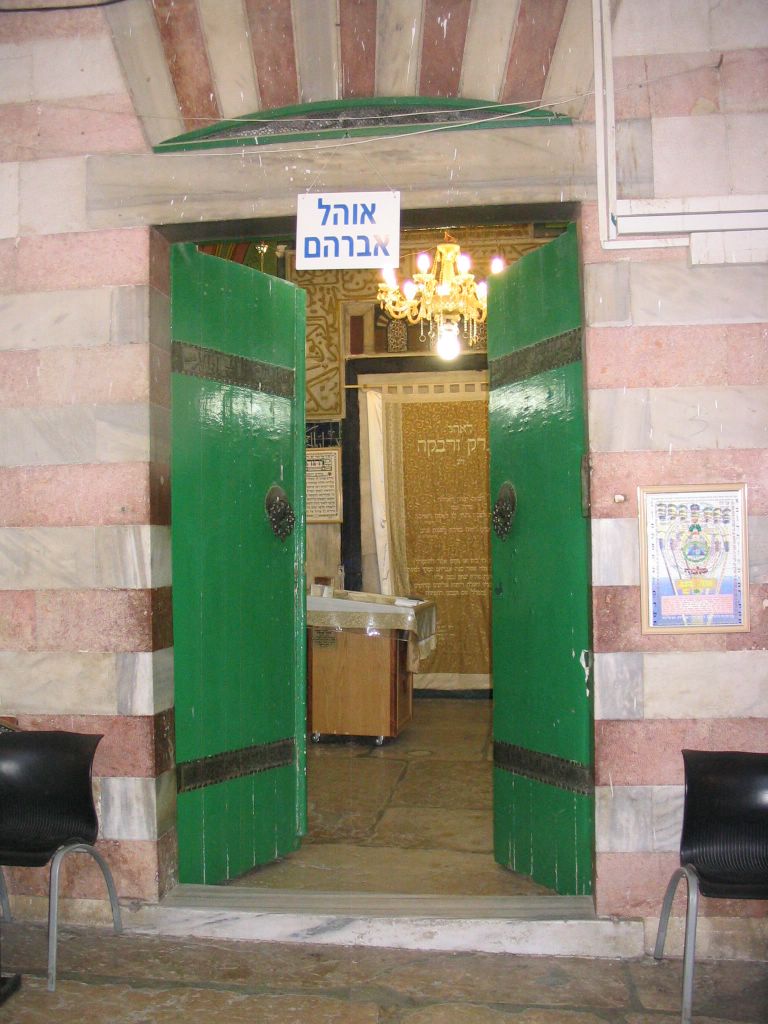
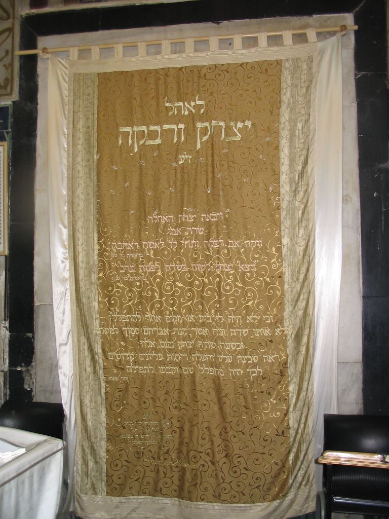
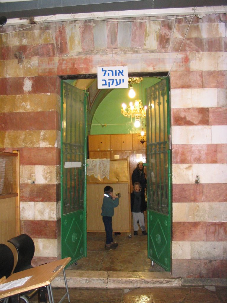
Ohel Yitzchok Which is usualy closed but was open for Chol Hamod.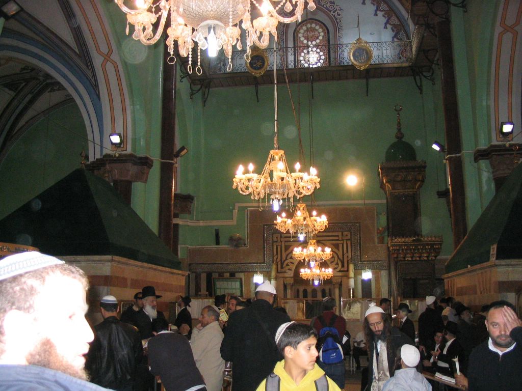
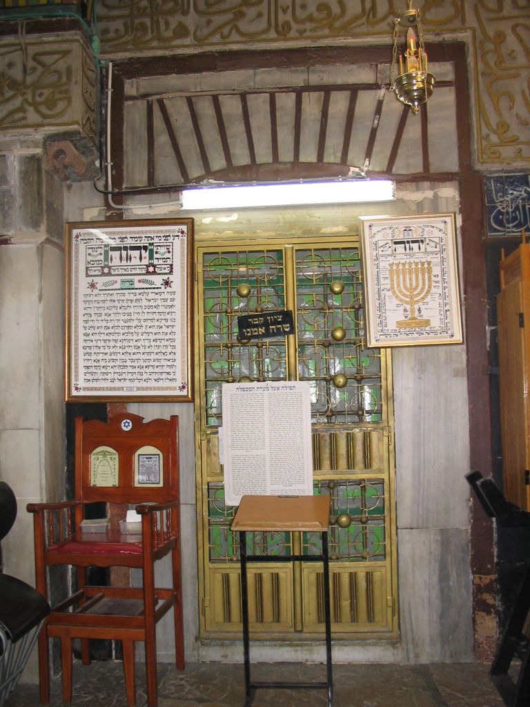
This is Where Avner Ben Ner is buried.

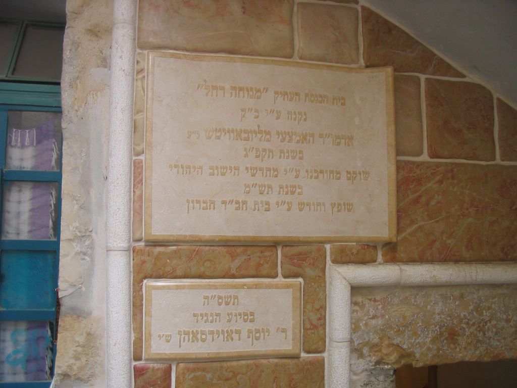
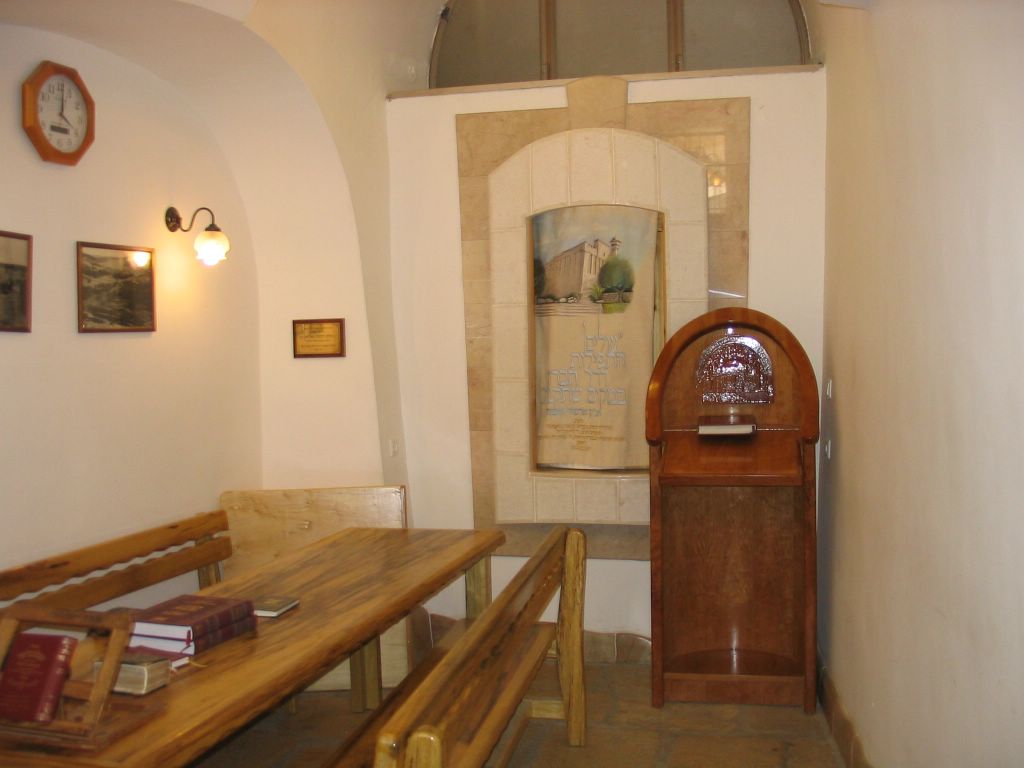
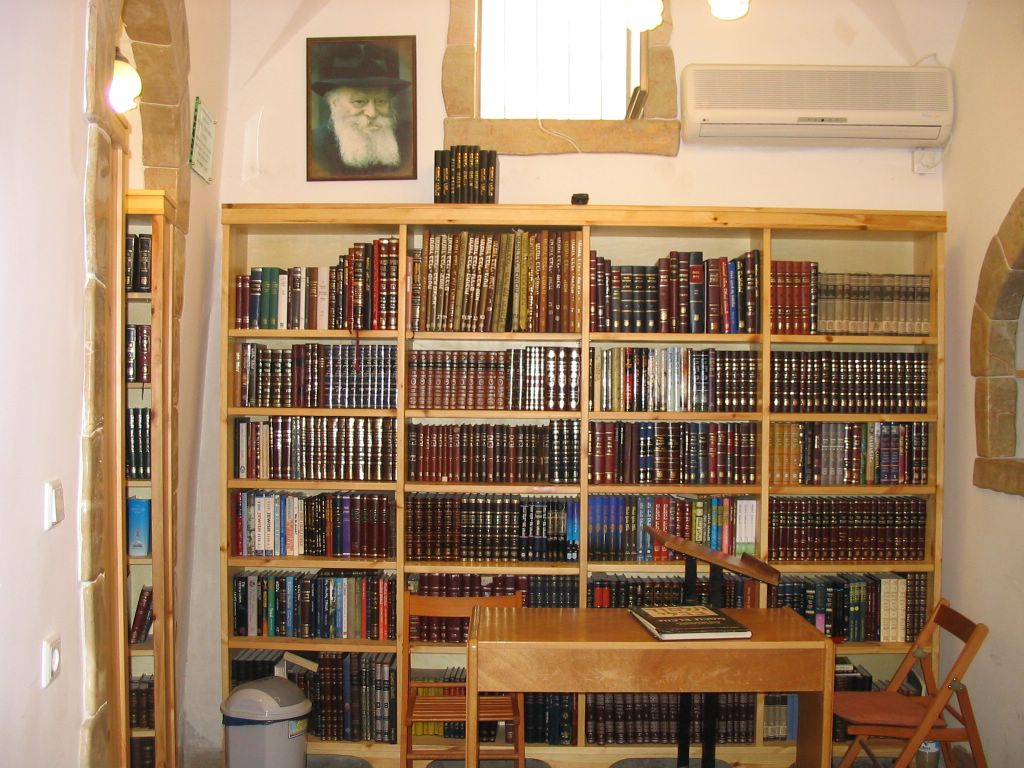
Chabad Of Chevron
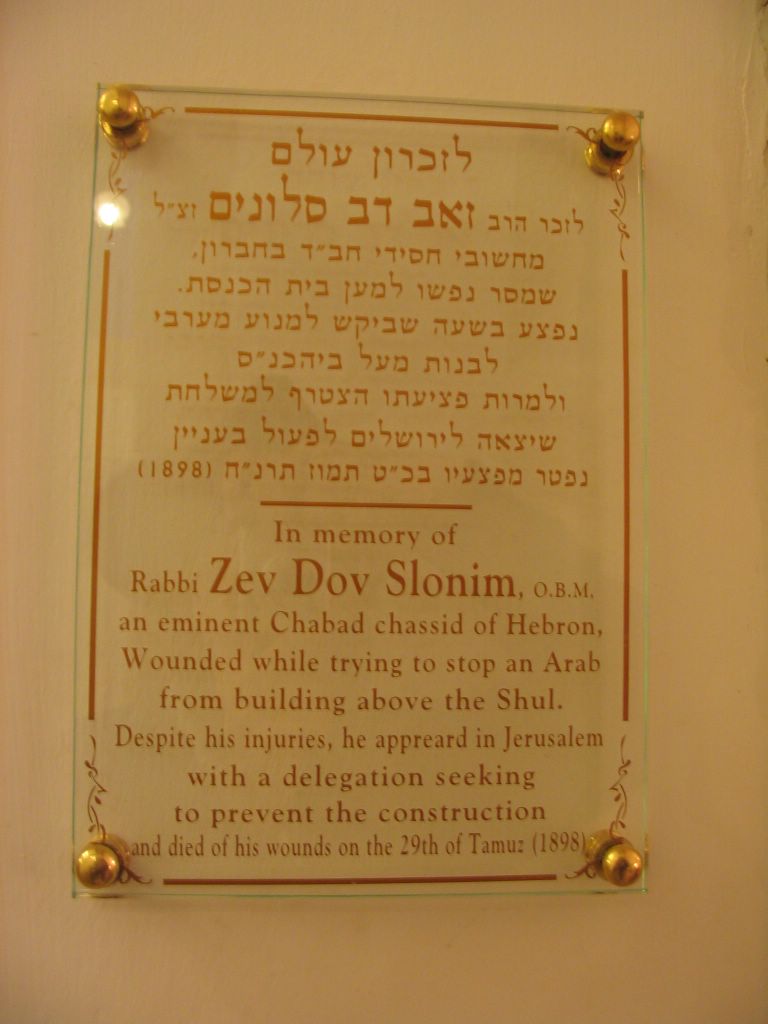
This is the place where Shalhevet Techiya Pass Z"L HY"D was killed.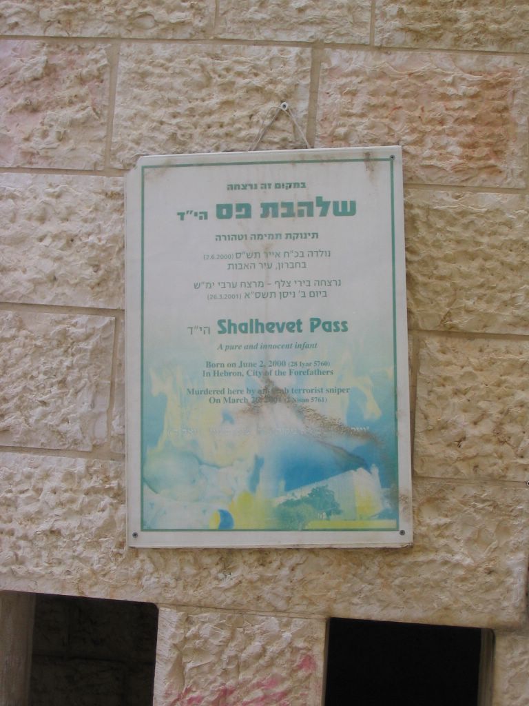
Shalhevet Techiya Pass Z"L
Mar 26, 2001 - Shalhevet Pass, age 10 months, was killed by sniper fire at the entrance to the Avraham Avinu neighborhood in Hebron.
Shalhevet, seated in her stroller, was going with her parents to visit her grandparents in the Avraham Avinu neighborhood in Hebron. A Palestinian sniper opened fire from the Abu Sneneh neighborhood on the hill opposite. Shalhevet was fatally wounded by a shot to the head. Her father, Yitzhak, was moderately wounded in both legs.
Her parents, Yitzhak and Oriya, have been married for about two years. Shalhevet was their first child. Yitzhak is a yeshiva student. Oriya, who grew up in Hebron, works as a teacher's aide in a nursery school.
The family has known terrorist attacks in the past. In November 1993, Oriya's father was attacked and seriously injured by two axe-wielding Palestinians on his way to morning prayers near the Machpela Cave. In January 1996, Oriya's sister, Orital, then 14, was stabbed in the back by a Palestinian near the Hebron market. This past March 10, Yitzhak's brother was shot in the leg while visiting the family in Hebron.
Shalhevet was buried in the ancient Jewish cemetery in Hebron.
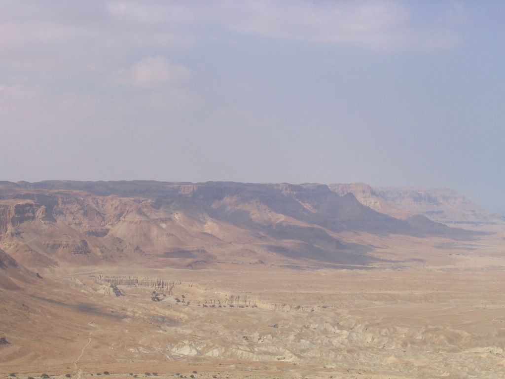
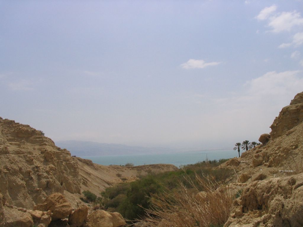
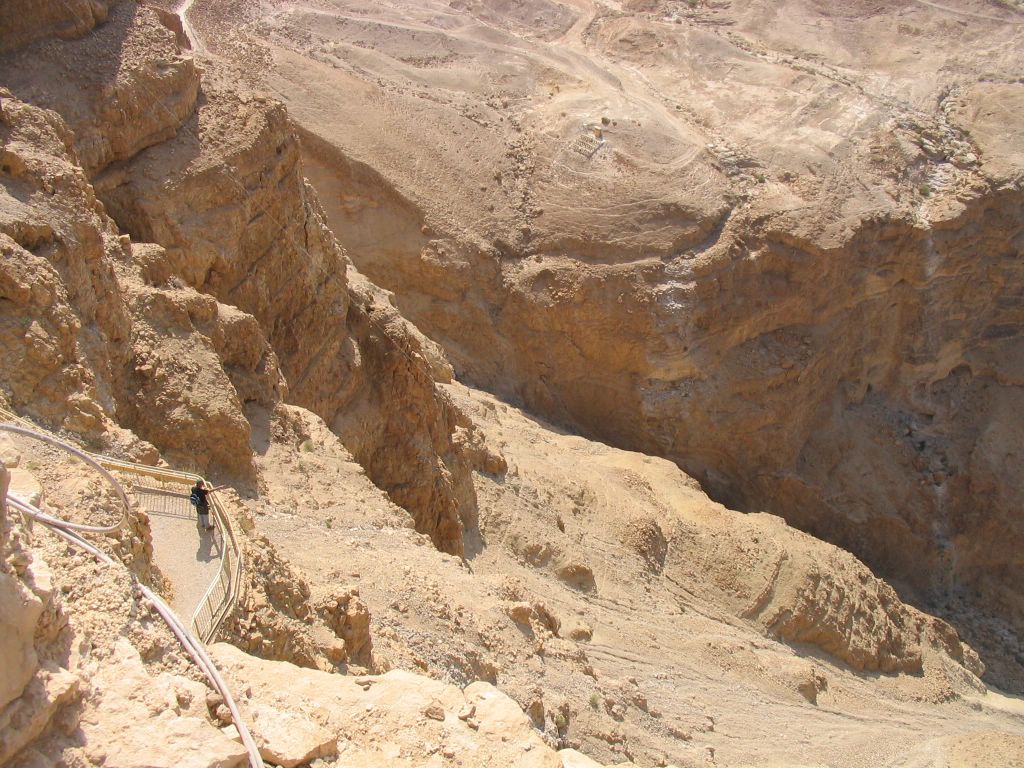
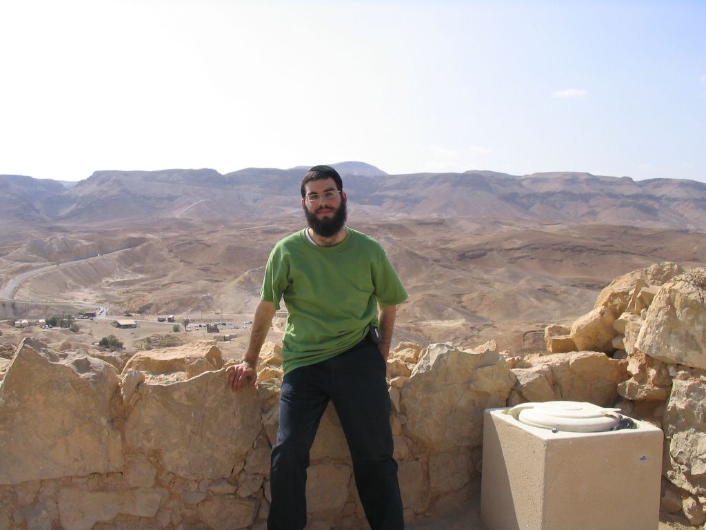
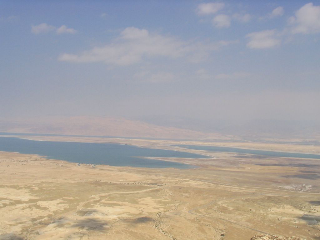
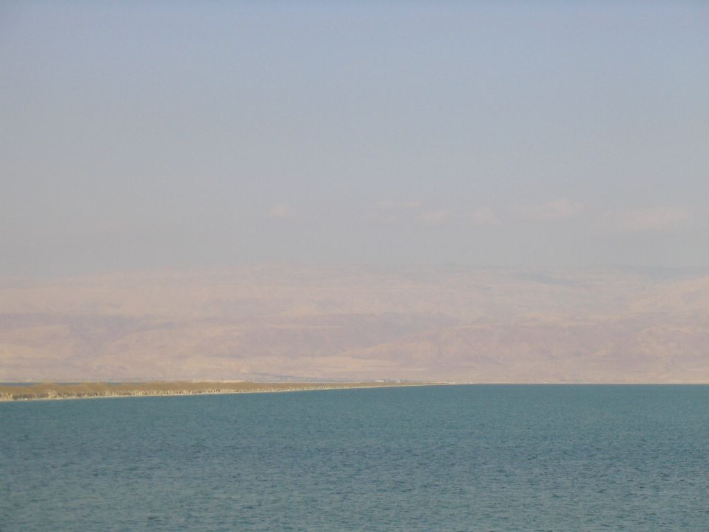
Day 22 - Monday - Ein Gedi - Masada - Dead Sea.
Ein Gedi


Ein Gedi (עין גדי) is an oasis near the Dead Sea. It is known for its caves, springs, and rich animal life, including the ibex. It is mentioned in the Song of Songs, "My beloved is unto me as a cluster of henna flowers in the vineyards of Ein Gedi" (1:14). According to Jewish tradition David hid from Saul in the caves here.
Masada and the caves of Qumran are located nearby. Location
A kibbutz, founded in 1956, is located by the oasis, offering tourist attractions and using local weather to cultivate out-of-season produce. Prior to the founding of the kibbutz, the Ein Gedi area had not been inhabited for 500 years.
Ein Gedi national park
Ein Gedi National Park is one of the most important oases in Israel. The park lies on the eastern border of the Judean Desert, on the Dead Sea's coast. Ein Gedi National Park includes two streams with flowing water year-round: David Stream and Arugot Stream. The park is a sanctuary for many types of plant and animal life such as the ibex. In the summer of 2005, nearly two-thirds of the oasis burned to the ground after a tourist dropped a lit cigarette onto the park grounds.
The botanic garden
In the kibbutz area a botanical garden was established. It lies on an area of 100 dunams (100,000 m²). There you can find more than 900 species of plants from all over the world. It became a formal botanical garden in 1994.
The Mini Fall
The Big Fall
Climbing Ein Gedi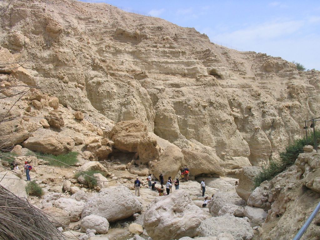
Rams in middle of the dessert.

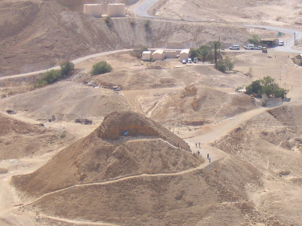
Masada
Masada is a Latin corruption of the Hebrew name Metzada (מצדה), derived from the word "metzuda" (מצודה), meaning "fortress". It is the site of ancient palaces and fortifications in Israel on top of an isolated rock plateau on the eastern edge of the Judean desert overlooking the Dead Sea. Masada became famous for the 73 CE battle (one of the last in the Great Jewish Revolt) between the site's Jewish defenders and besieging Roman troops, during which almost all surviving defenders committed mass suicide when defeat became imminent.| Siege of Masada | |||||||||
|---|---|---|---|---|---|---|---|---|---|
| Part of First Jewish-Roman War | |||||||||
 Masada seen from the east | |||||||||
| |||||||||
| Combatants | |||||||||
| Jewish Zealots | Roman Empire | ||||||||
| Commanders | |||||||||
| Elazar ben Ya'ir | Lucius Flavius Silva | ||||||||
| Strength | |||||||||
| ~1,000 | 15,000 | ||||||||
| Casualties | |||||||||
| Virtually all inhabitants | Unknown, if any | ||||||||
Geography
The cliffs on the east edge of Masada are about 451 meters high, dropping off to the Dead Sea, and the cliffs on the west are about 100 meters high; the natural approaches to the cliff top are very difficult. The top of the plateau is flat and rhomboid shaped, approximately 600 by 300 meters. There was a casemate wall around the top of the plateau totalling 1400 meters long and 4 meters thick with many towers, and the fortress included storehouses, cisterns that were refilled by rainwater, barracks, palaces and an armory. Three narrow, winding paths led from below to fortified gates. Location
History
According to Flavius Josephus, a 1st century Jewish historian, Herod the Great fortified Masada between 37 and 31 BCE as a refuge for himself should his Jewish subjects rise up against him. In 66 CE, at the beginning of the Great Jewish Revolt against the Romans, a group of Jewish rebels called the Zealots (Heb: kana'im, lit: zealous ones) commanded by Elazar ben Ya'ir, took Masada from the Roman garrison stationed there. In 70 CE they were joined by additional Zealots and their families who were expelled from Jerusalem by the other Jews living there shortly before the destruction of Jerusalem, and for the next two years used Masada as their base for raiding and harassing Roman and Jewish settlements alike.

Then, in 72 CE, the Roman governor of Iudaea Province, Lucius Flavius Silva, marched against Masada with the Roman legion X Fretensis and laid siege to the fortress. After failed attempts to breach the wall, they built a circumvallation wall and then a rampart against the western face of the plateau, using thousands of tons of stones and beaten earth. Josephus does not record any major attempts by the Zealots to counterattack the besiegers during this process, a significant difference from his accounts of other sieges against Jewish fortresses, suggesting that perhaps the Zealots lacked the equipment or skills to fight the Roman legion. It is also believed that the Romans may have used Jewish slaves to build the rampart, whom the Zealots were reluctant to kill because of their beliefs.

The rampart was complete in the spring of 73 CE after approximately two to three months of siege, allowing the Romans to finally breach the wall of the fortress with a battering ram. When they entered the fortress, however, the Romans discovered that its approximately one thousand defenders had set all the buildings but the food storerooms ablaze and committed mass suicide rather than face certain capture or defeat by their enemies. Because the Jewish religion discourages the act of suicide, however, the defenders were reported to have drawn lots and slain each other in turn, down to the last man, who would be the only one to actually take his own life. The storerooms were apparently left standing to show that the defenders retained the ability to live and chose the time of their death. This account of the siege of Masada was apparently related to Josephus by two women who survived the suicide by hiding inside a cistern along with five children and repeated Elazar ben Yair's final exortation to his followers, prior to the mass suicide, verbatim to the Romans.

The site today

The site of Masada was identified in 1842 and extensively excavated in 1963-1965 by an expedition led by Israeli archeologist Yigael Yadin. A pair of cable cars now carries those visitors who do not wish to climb the ancient snake path, now restored on the eastern side of the mountain (access via the Dead Sea road). The area remained largely untouched by humans or nature in the past two millennia, due to the location's remoteness from human habitation and its arid environment. The Roman ramp still stands on the western side and can be climbed on foot. Many of the ancient buildings were restored from their remnants, as were the wall-paintings of Herod's two main palaces, and the Roman-style bath-houses that he built. The synagogue, storehouses, and houses of the Jewish rebels were also found and restored. The meter-high circumvallation wall that the Romans built around Masada can be seen, together with 11 barracks for the Roman soldiers just outside this wall. Water cisterns two-thirds of the way up the cliff drain the nearby wadis by an elaborate water system, which explains how the rebels managed to have enough water for such a long time.
The Masada legacy has been used in a similar context by the British Mandate of Palestine, which planned the Masada plan to man defensive positions on Mount Carmel with Jewish Palmach fighters, in order to stop Erwin Rommel's expected drive through Palestine in 1942. The plan was abandoned following Rommel's defeat at El Alamein. Today Masada is used by the Israeli army and youth movements for swearing-in ceremonies, where participants swear the oath that "Masada shall never fall again".
Masada has been a UNESCO's World Heritage Site since 2001. An audio-visual show is presented nightly on the western side of the mountain (access by car from the Arad road or by foot, down the mountain via the Roman ramp path).
Masada
Ski Lift to get up the Mountain.
Model of Masada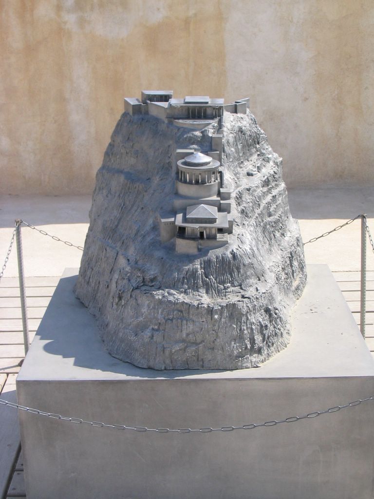

Where The Mikvah used to be on Masada
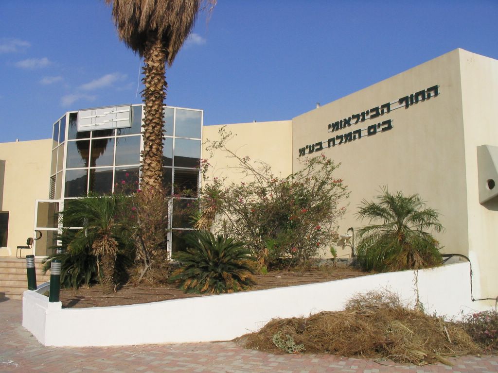
Dead Sea

The Dead Sea (Hebrew ים המלח) , (Arabic البحر الميت) is the lowest exposed point on the Earth's surface. It is on the border between the West Bank, Israel, and Jordan on the Jordan Rift Valley (32°30’N 35°30’E). This endorheic body of water is the deepest hypersaline lake in the world.
The Dead Sea is 67 km long, up to 18 km wide and 799 m below sea level in depth at its deepest point. The surface elevation of the Dead Sea and therefore its immediate shoreline is the lowest land point on the face of the earth. As of 2006 its surface is at an elevation of 418 m (1371 ft) below sea level, although this is reducing over time [1].
The Dead Sea has attracted interest and visitors from around the Mediterranean basin for thousands of years. It was a place of refuge for King David, it was one of the world's first health resorts for Herod the Great, and it has been the supplier of products as diverse as balms for Egyptian mummification to potash for fertilizers.
In Hebrew the Dead Sea is called the - meaning "sea of salt", or Yam ha-Mavet - meaning "sea of death". In past times it was the "Eastern Sea" or the "Sea of Arava". In Arabic the Dead Sea is called meaning "the Dead Sea", or less commonly Bahr Lūţ meaning "the Sea of Lot".Historically, another Arabic name was the "Sea of Zoar", after a nearby town. To the Greeks, the Dead Sea was "Lake Asphaltites" (see below).The Dead Sea actually has water flowing into it. The Jordan River runs into the Dead Sea.
Natural history
The Dead Sea is located in the Dead Sea Rift, that is part of a long fissure in the Earth's surface called the Great Rift Valley. The 6000 km (3700 mile) long Great Rift Valley extends from the Taurus Mountains of Turkey to the Zambezi Valley in southern Africa. The Great Rift Valley formed in Miocene times as a result of the Arabian Plate moving northward and then eastward away from the African Plate.
Around three million years ago what is now the valley of the Jordan River, Dead Sea, and Wadi Arabah/Nahal Arava was repeatedly inundated by waters from the Mediterranean Sea. The waters formed in a narrow, crooked bay which was connected to the sea through what is now the Jezreel Valley. The floods of the valley came and went depending on long scale climatic change. The lake that occupied the Dead Sea Rift, named "Lake Sodom", deposited beds of salt, eventually coming to be 3 km (2 miles) thick.
According to geological theory, approximately two million years ago the land between the Rift Valley and the Mediterranean Sea rose to such an extent that the ocean could no longer flood the area. Thus, the long bay became a long lake.
The first such prehistoric lake is named "Lake Gomorrah". Lake Gomorrah was a freshwater or brackish lake that extended at least 80 km (50 miles) south of the current southern end of the Dead Sea and 100 km (60 miles) north, well above the present Hula Depression. As the climate turned more arid, Lake Samra shrank and became saltier. The large, saltwater predecessor of the Dead Sea is called "Lake Lisan".

In prehistoric times great amounts of sediment collected on the floor of Lake Gomorra. The sediment was heavier than the salt deposits and squeezed the salt deposits upwards into what are now the Lisan Peninsula and Mount Sedom (on the southwest side of the lake). "Geologists explain the effect in terms of a bucket of mud into which a large flat stone is placed, forcing the mud to creep up the sides of the pail". When the floor of the Dead Sea dropped further due to tectonic forces the salt mounts of Lisan and Mount Sedom stayed in place as high cliffs. (see salt domes)
The period 23,000 years ago to 18,000 years ago was very dry and the surface level of Lake Lisan fell to a point well below the Dead Sea's surface level today. At the sea's minimum, its waters may have been over 600 m (2,100 feet) below sea level.
Around 12,000 years ago this tiny puddle of the Lake Lisan minimum began to steadily grow again. Around a few thousand years ago, the Dead Sea was about as large as its northern basin is today. There was no southern basin until the late Middle Ages.
The Jordan River is the only major stream flowing into Dead Sea. There are no outlet streams.
The northern part of the Dead Sea receives scarcely 100 mm (4 inches) of rain a year. The southern section barely 50 mm (2 inches). The Dead Sea zone's aridity is due to the rainshadow effect of the Judean Hills. The highlands east of the Dead Sea receive more rainfall than the Dead Sea itself.
The mountains of the western side, the Judean Hills, rise less steeply from the Dead Sea than do the mountains of the eastern side. The mountains of the eastern side are also much higher. Along the southwestern side of the lake is a 210 m (700 ft) tall halite formation called "Mount Sedom".
Chemistry and health effects

Until the winter of 1978-1979, the Dead Sea was composed of two stratified layers of water that differed in temperature, density, age, and salinity. The topmost 35 m or so of the Dead Sea had a salinity that ranged between 300 and 400 parts per thousand and a temperature that swung between 19 °C (66 °F) and 37 °C (98 °F). Underneath a zone of transition, the lowest level of the Dead Sea had waters of a consistent 22 °C (72 °F) temperature and complete saturation of sodium chloride (NaCl). Since the water near the bottom is saturated, the salt precipitates out of solution onto the sea floor.
Beginning in the 1960s water inflow to the Dead Sea from the Jordan River was reduced as a result of large-scale irrigation and generally low rainfall. By 1975 the upper water layer of the Dead Sea was actually saltier than the lower layer. The upper layer nevertheless remained suspended above the lower layer because its waters were warmer and thus less dense. When the upper layer finally cooled down so that its density was greater than the lower layer the waters of the Dead Sea, after many centuries, finally mixed and the lake was a homogeneous body of water. Since then, the stratification has begun to redevelop.
The mineral content of the Dead Sea is significantly different from that of ocean water, consisting of approximately 53% magnesium chloride, 37% potassium chloride and 8% sodium chloride (salt) with the remainder comprised of various trace elements.
The concentration of sulfate, SO42-, ions is very low, and the bromide ion concentration is the highest of all waters on Earth. Chlorides neutralize most of the calcium ions in the Dead Sea and its surroundings. While in other seas sodium chloride is 97% of the salts, in the Dead Sea the quantity of NaCl is only 12-18 percent. The water temperature varies from 19 °C in February to 31 °C in August.
Comparison between the chemical composition of the Dead Sea to other lakes and oceans show that the salt concentration in the Dead Sea is 31.5% (the salinity fluctuates somewhat). Because of its unusually high concentration of salt, anyone can easily float in the Dead Sea because of natural buoyancy as a result of the higher density of the water. In this the Dead Sea is similar to the Great Salt Lake in Utah, in the United States.
The water of the Dead Sea has a greasy feel to it. The water stings cuts, and causes pain if it comes in contact with the eyes.
One of the most unusual properties of the Dead Sea is its discharge of asphalt. From deep seeps, the Dead Sea constantly spits up small pebbles of the black substance. After earthquakes, chunks as large as houses may be produced.
The Dead Sea area has become a major center for health research and treatment for several reasons. The mineral content of the waters, the very low content of pollens and other allergens in the atmosphere, the reduced ultraviolet component of solar radiation, and the higher atmospheric pressure at this great depth each have specific health effects. For example: persons suffering reduced respiratory function from diseases such as cystic fibrosis, seem to benefit from the increased atmospheric pressure.
Flora and fauna

The sea is called "dead" because its high salinity means no fish or macroscopic aquatic organisms can live in it, though minuscule quantities of bacteria and microbial fungi are present.
In times of flood the salt content of the Dead Sea can drop from its usual 35% salinity to 30% or lower. In the wakes of rainy winters the Dead Sea temporarily comes to life. In 1980, after one such rainy winter, the normally dark blue Dead Sea turned red. Researchers from Hebrew University found the Dead Sea to be teeming with a type of algae called Dunaliella. The Dunaliella in turn nourished carotenoid-containing (red-pigmented) halobacteria whose presence is responsible for the color change. Since 1980 the Dead Sea basin has been dry and the algae and the bacteria have not returned in measurable numbers.
Many animal species make their homes in the mountains surrounding the Dead Sea. A hiker can see camels, ibexes, hares, hyraxes, jackals, foxes, and even leopards. Hundreds of bird species inhabit the zone as well. Both Jordan and Israel have established nature reserves around the Dead Sea.
The delta of the Jordan river was formerly a veritable jungle of papyrus and palm trees. Flavius Josephus described Jericho as "the most fertile spot in Judea". In Roman and Byzantine times sugarcane, henna, and sycamore all made the lower Jordan valley quite wealthy. One of the most valuable products produced by Jericho was the sap of the balsam tree, which could be made into perfume.
By the nineteenth century Jericho's fertility was a thing of the past.
Human history

The human history of the Dead Sea goes all the way back to remote antiquity. Just north of the Dead Sea is Jericho, the oldest continually occupied town in the world. Somewhere, perhaps on the Dead Sea's southeast shore, are the cities mentioned in the Book of Genesis which were destroyed in the times of Abraham: Sodom and Gomorra and the three other "Cities of the Plain". King David hid from Saul at Ein Gedi nearby.
The Greeks knew the Dead Sea as "Lake Asphaltites", due to the naturally surfacing asphalt. Aristotle wrote about the remarkable waters. During the Egyptian conquest it is said that Queen Cleopatra obtained exclusive rights to build cosmetic and pharmaceutical factories in the area. Later, the Nabateans discovered the value of bitumen extracted from the Dead Sea needed by the Egyptians for embalming their mummies.
Herod the Great, Jesus, and John the Baptist were closely linked with the Dead Sea and its surroundings. In Roman times the Essenes settled in Qumran on the Dead Sea's northern shore. There, in the soft marl of the Dead Sea area, they carved out storage caves for their library. Two thousand years later their library was found and given the name "the Dead Sea Scrolls".
King Herod built several palaces on the Western Bank of the Dead Sea. The most famous was Masada, where, in 66-70 AD, a small group of rebellious Jewish zealots held out against the might of the Roman Legion.
The remoteness of the region attracted Greek Orthodox monks since the Byzantine era. Their monasteries such as Saint George in Wadi Kelt and Mar Saba in the Judean Desert are places of pilgrimage. Bedouin tribes have continuously lived in the area and more recently explorers and scientists arrived to analyze the minerals and conduct research into the unique climate. Since the 1960s, tourists from all the over world have also explored the Dead Sea region.
Potash and Salt Works

In the early part of the 20th century, the Dead Sea began to attract interest from chemists who deduced that the Sea was a natural deposit of potash and bromine. The Palestine Potash Company was chartered in 1929 (after its founder, Moses Novomeysky, a Jewish engineer from Siberia, worked for the charter for over ten years). The first plant was on the north shore of the Dead Sea at Kalia and produced potash, or potassium chloride, by solar evaporation of the brine. Employing Arabs and Jews, it was an island of peace in turbulent times. The company quickly grew into the largest industrial site in the Middle East and in 1934 built a second plant on the southwest shore, in the Sodom area, south of the 'Lashon' region of the Dead Sea. The Dead Sea Works Ltd. was established in 1952 as a state-owned company to extract potash and other minerals from the Dead Sea.
From the Dead Sea brine, Israel produces (2001) 1.77 million tons potash, 206,000 tons elemental bromine, 44,900 tons caustic soda, 25,000 tons magnesium metal, and sodium chloride. On the Jordanian side of the Dead Sea, the Arab Potash Co. (APC), formed in 1956, produces 2.0 million tons of potash annually, as well as sodium chloride and bromine. Both companies use extensive salt evaporation pans that have essentially diked the entire southern end of the Dead Sea for the purpose of producing carnallite, potassium magnesium chloride, which is then processed further to produce potassium chloride. The power plant on the Israeli side allows production of magnesium metal (by a subsidiary, Dead Sea Magnesium Ltd.). The salt evaporation pans are visible from space.
Saving the Dead Sea

The Dead Sea is rapidly shrinking due to diversion of incoming water. Between 1930 and 1997 it fell 21 m [2]. Although the Dead Sea may never entirely disappear (because evaporation slows down as surface area decreases and saltiness increases), the Dead Sea as we know it could become a thing of the past.
Because it is not realistic to cease using the Jordan River for human needs, one idea to save the Dead Sea is to bring in water from the Mediterranean or Red Sea, either through tunnels or canals. Although a Mediterranean structure would be shorter, Israel is now committed to building a Red Sea canal in deference to Jordan's needs. The plan is to pump water 400 ft (120 m) up the Arava/Arabah from Aqaba or Eilat, tunnel under the highest point of the Arava/Arabah valley, and then canalize the river of seawater as it falls 1700 ft (520 m) to the Dead Sea. The desalination plant would be constructed in Jordan.
On May 9th, 2005, Jordan, Israel, and the Palestinian Authority signed an agreement to begin feasibility studies on the project—to be officially known as the "Two Seas Canal". The scheme calls for the production of 870 million cubic meters of fresh water per year and 550 megawatts of electricity. The World Bank is supportive of the project.
See also Dead Sea canal.
Dead Sea
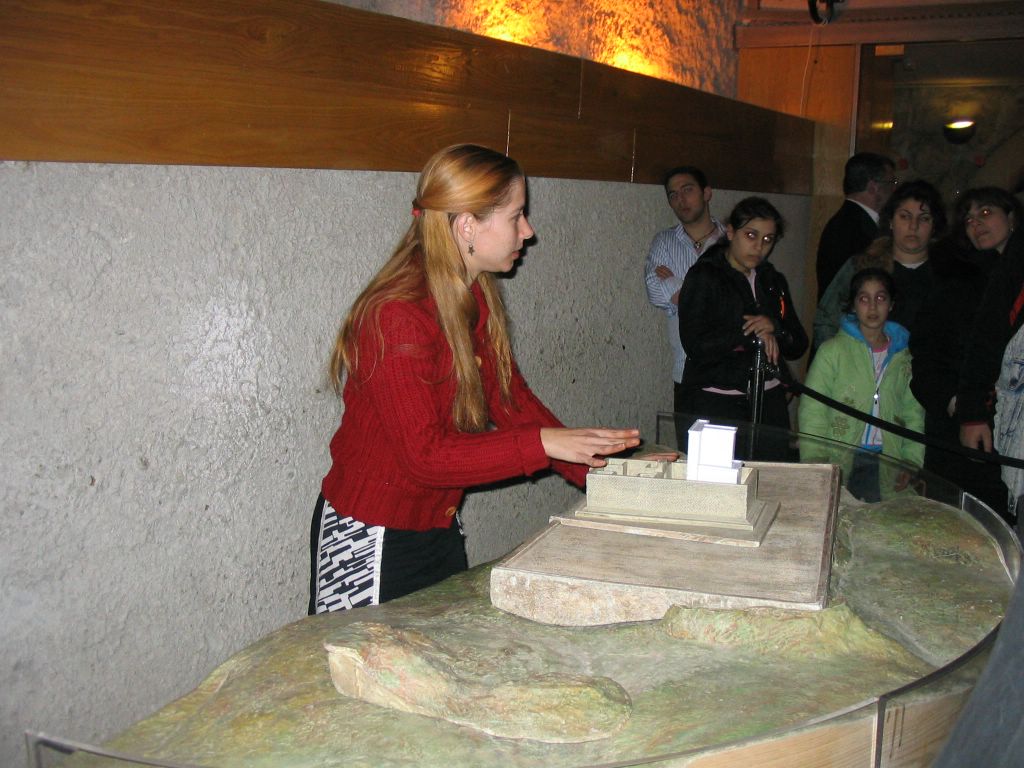
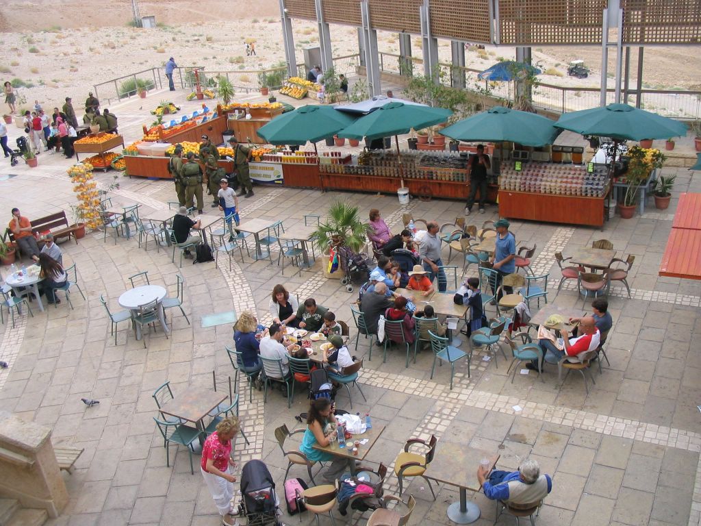
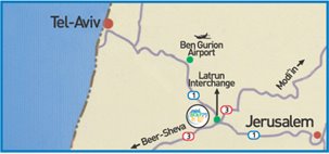
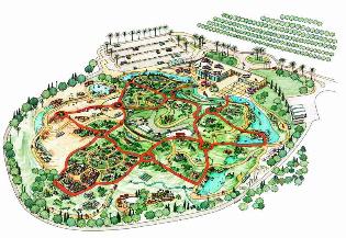
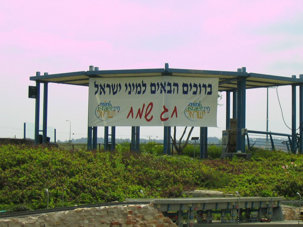
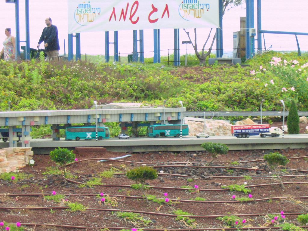
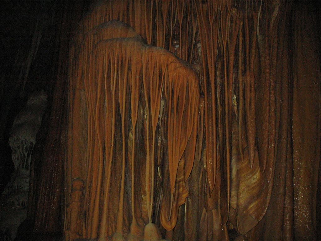
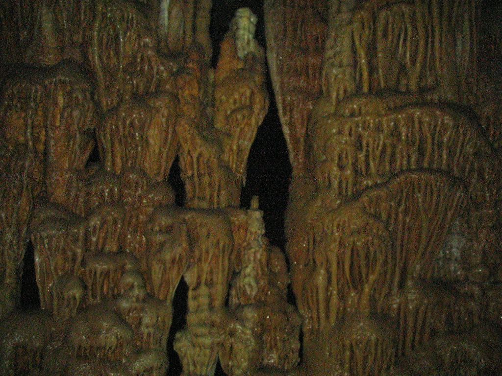
Day 23 - Tuesday - Mini Israel - Stalactite Caves.
Mini Israel,
See it All...Small!
The Park displays hundreds of models that are exact copies of sites, buildings and landscapes from around the country. The models are built at a scale of 1:25, which means that every real meter is scaled down to 4 cm.
The exhibited models are of architectural, historical, religious, archeological and social importance. They are surrounded by colorful flowers, miniature vegetation, bonsai trees and thousands of “Israeli” figures who are 7 cm tall.
The Park is located in Latrun, just off the main highway from Tel Aviv to Jerusalem and only a few minutes from Ben Gurion Airport.
Come and have fun, share our excitement and experience the beauty of Israel!

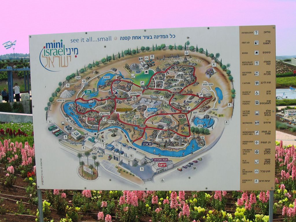
Mount Hermon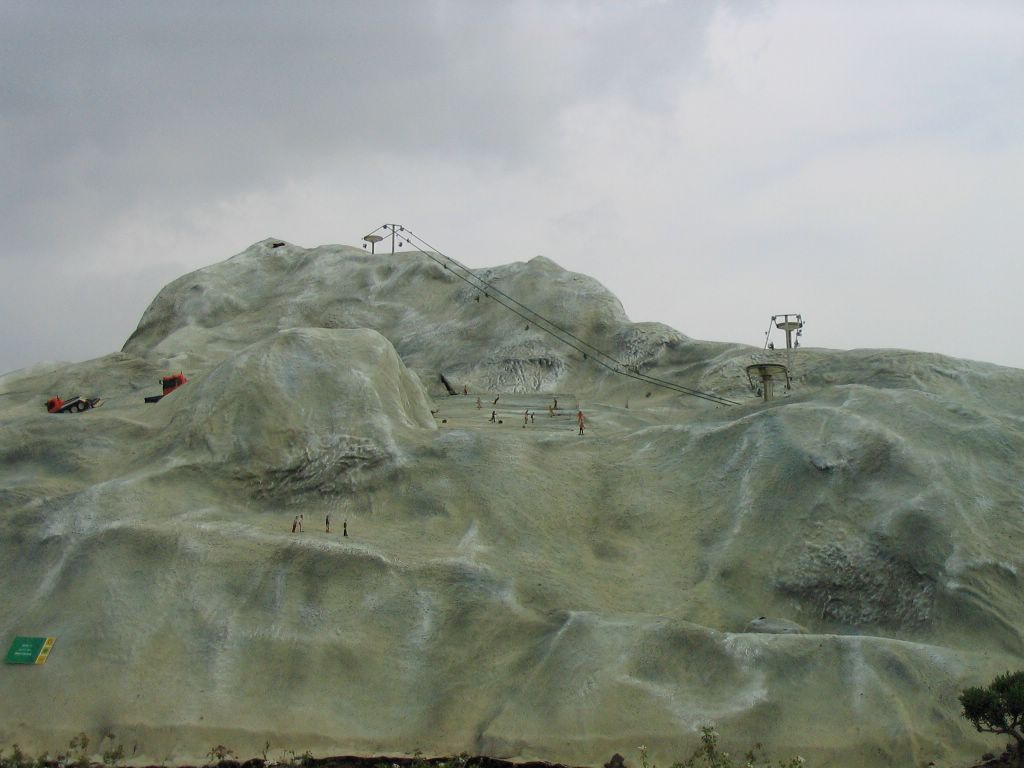
Rambam's Kever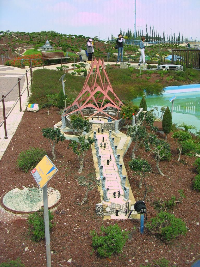

Tnuva Factory
Where Yisro is Buried
where Yonathan ben Uzziel is buried-Amukah.

Tel-Aviv Airport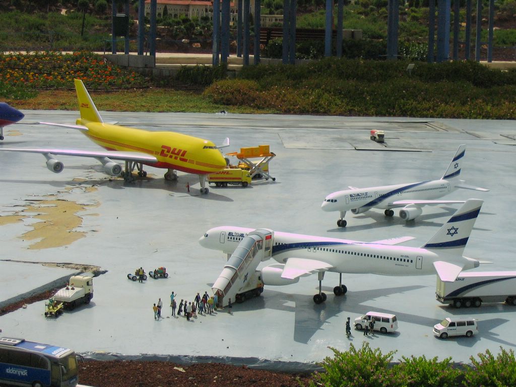
Stadium
Yad VaShem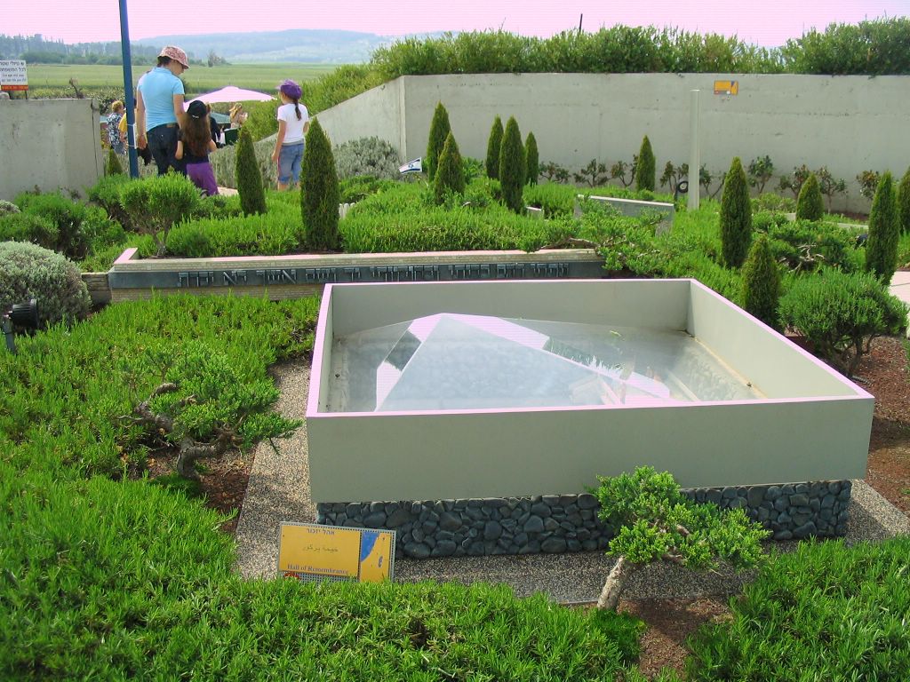
Knesset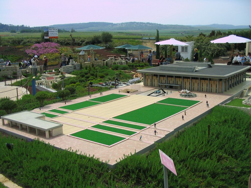
The Great Synagogue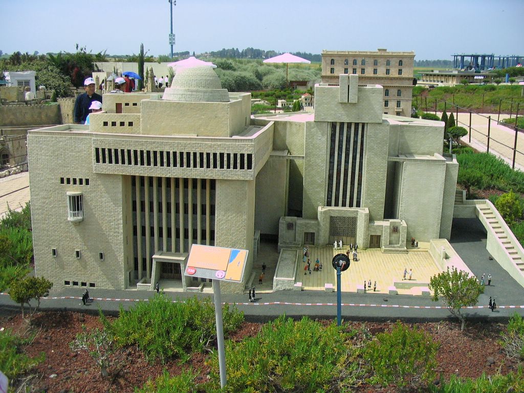
Dome Of The Rock
The Kotel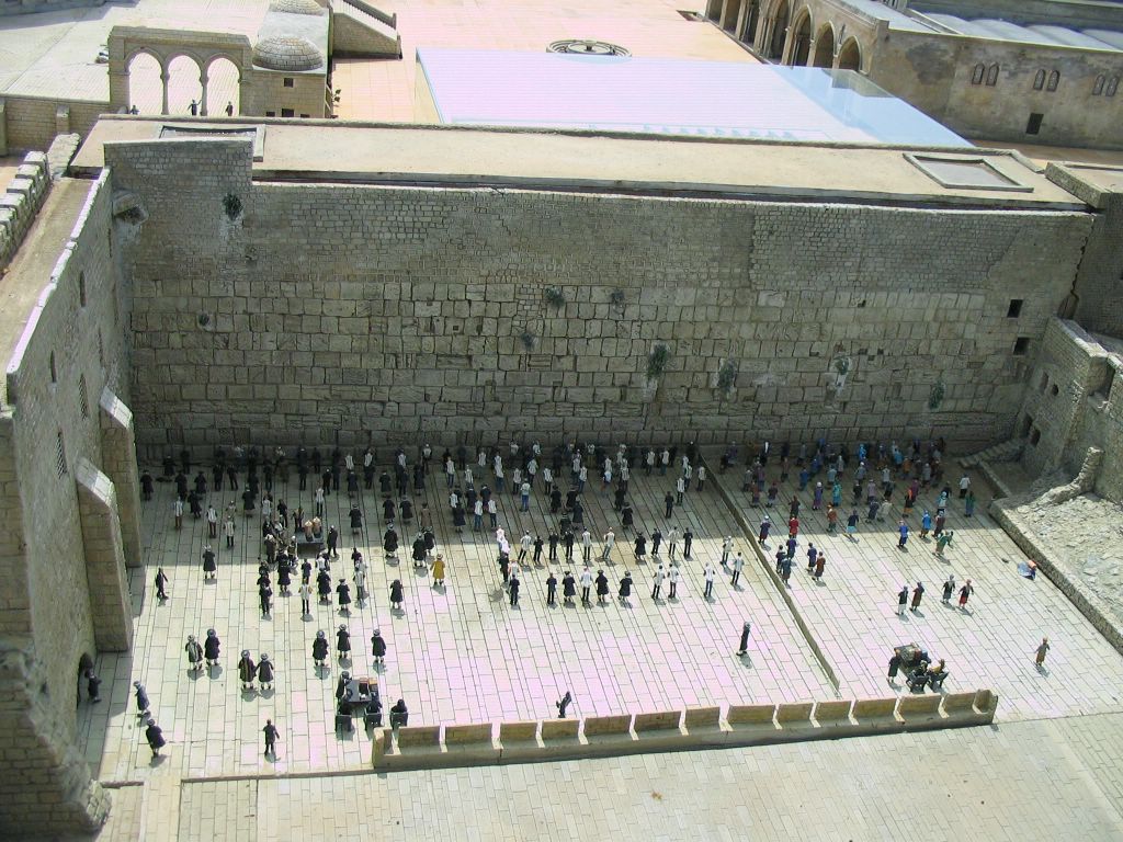
Masada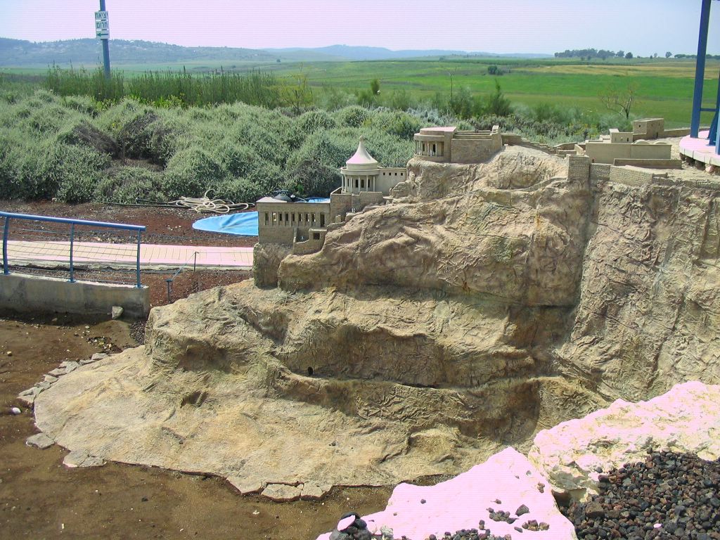
Dan Hotel Eilat
Tel Aviv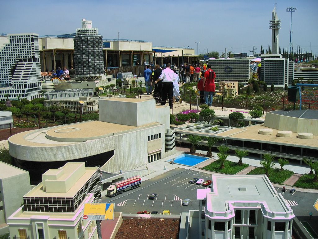

Stalactive Caves
Stalactite Cave at the Avshalom Reserve
Where the imagination runs riot
The Stalactite Cave Nature Reserve (also called Soreq Cave) is dedicated to the memory of Avshalom Shoham. The 82-meter-long, 60-meter-wide cave is on the western slopes of the Judean Hills outside the city of Beit Shemesh. It was discovered accidentally by workers blasting at a nearby quarry. Although the Soreq Cave is relatively small, the variety of its formations rivals that seen in much larger stalactite caves. Some of the stalactites are 300 thousand years old, and scientists use them to study climactic changes that have transpired in this area from the time of their formation until the present. Although some stalactites are even older, they cannot be precisely dated using the instruments currently available.
The stalactites hanging from the ceiling of the cave are up to four meters long and on occasion meet up with stalagmites growing from the floor. Stalactites range in diameter from a few millimeters to a few meters. Some look like everyday objects - shelves, sheets of cloth, branches, and coral - and others have shapes never before seen. A number of the stalactites and stalagmites are still active.
A visit to the cave includes a slide show and a guided tour. On Fridays, when there are no tours, photography is permitted.

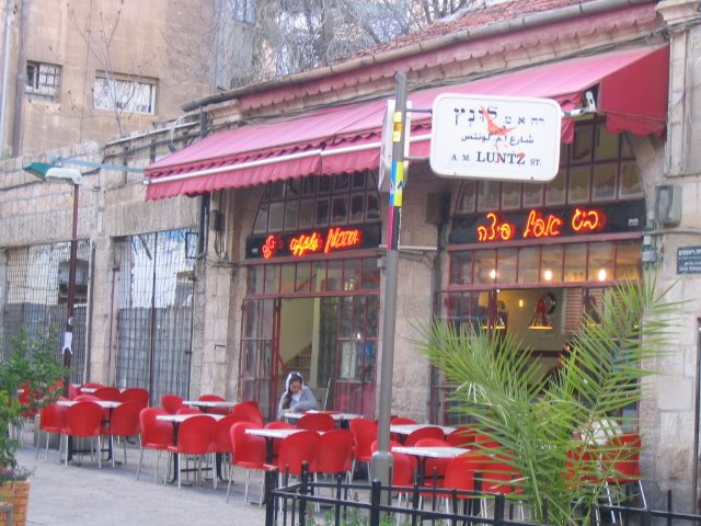
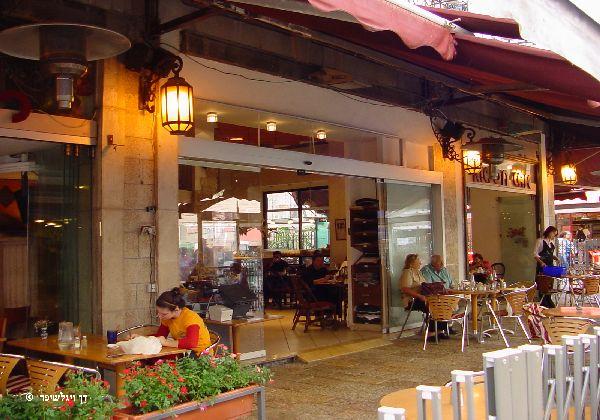
Day 24 - Thursday-Yom tov. we had to eat Chometz so we went to Cafe Rimon.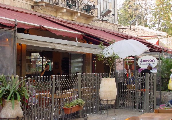
Day 25 - Thursday Tel-Aviv- Ben Yehudah-Burgers Bar.
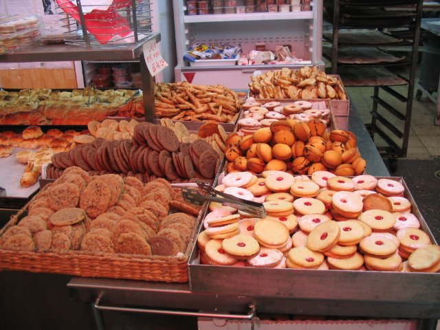
Day 26 - Friday - Kosel-Bakery-and back to Kfar Chabad.
Day 27 - Shabbos.
Day 28 - Sunday Flight At 6:00 A.M. Israel - Warsaw
posted by Zalmen @ 9:58 AM
5 comments
![]()
![]()

5 Comments:
Good stuff mate... brought back many many fond memories.
I missed the Mini-Israel park. It looks like loads of fun and the buildings look exactly like Tel Aviv, etc.
How long were you in Berlin for?
i'm really impressed! great work
Hi Zalmen-It's great to be able to keep up to date with all your travels.
Chanie (Zarchi) and Eli Wolf
BS"D
And here is what the Rebbe thought about how Jewish is the state of Israel...
http://www.chabadlibrary.org/books/admur/ig/19/7066.htm
Post a Comment
<< Home